


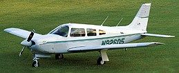
Theannual trek to Sun ‘n Fun was, as usual, a great deal of fun. Flying myPiper Arrow down and back is always the best part of the entire week, andthis year was no exception. The weather cooperated for the most part, andthe bird ran flawlessly.
When my wife and I departed Howell, Michigan, there was some rain inthe area, and we picked up an IFR clearance so we could climb right throughthe clouds. We didn’t have to go too far south before we were in the clear.
Our first fuel stop was at Hazard, Kentucky. I picked it because thecomputer showed it to be approximately a third of the total distance, andin a straight line between our starting point and destination. It turnedout to be a fine airport with good service, and friendly people. The secondstop was at Waycross, Georgia where a lunch of barbecue and hot dogs waslaid out for Sun ‘n Fun bound pilots. The third leg was as uneventful asthe other two until we got into the sequence for Lakeland and ended upfollowing a DC-3 who told controllers he was familiar with the approachprocedure, but wasn’t. He went from the powerplant directly into a downwindfor Runway 9 Right while I widened it out behind him to stay with the procedure.There weren’t too many airplanes in the area at the time, so there wereno ill effects from initially following the DC-3 off the procedure.
It was a typical cross country trip, and that week thousands of pilotsand airplanes made the long trek from their home bases to Lakeland. I talkedto one fellow who flew his restored Curtis Robin all the way from NorthernAlaska, and many others who didn’t cover nearly as many miles. But in everyinstance the pilot indicated that the reason for his or her success, andlack of problems along the way, was the amount of planning and preparationthey did before departure.
Whether you fly IFR or VFR on long trips you need to know as much informationabout your route of flight, proposed fuel stops, other alternate airports,navaids, and terrain features along the way before the wheels leave theground. That’s in addition to having a good understanding of the weatherand a feel for what it will do while you are enroute.
Scoping out the weather
It is difficult to plan a long cross country trip from one corner ofthe country to another without having to deal with some weather along theway. Seldom is the entire country clear, or even VFR, and it is generallypilots who don’t understand enough about the weather and the systems thatlie in wait who wind up in trouble.
I began watching the weather about five days in advance of our Lakelandtrip. The Weather Channel offers five day forecasts that give a good indicationof what can be expected on the travel day. What I saw indicated that wewould have VFR conditions along the entire route, and that proved to bethe case, except for the lingering rainshowers in our home area that werea result of a system that moved through a little slower than had been anticipated.
Drawing a line on a map and following it is not enough. If there ismountainous terrain along the way how do you know your airplane has theability to climb safely above it? Just because the highest terrain is depictedas 6,600 feet doesn’t mean your bird will make it across the range withoutincident. On my return trip from Lakeland last year it was a day aftera potent cold front had ripped through the area, and the winds aloft werevery strong from the northwest. After departing Washington, Georgia withfull tanks, two friends, and camping gear aboard, the Arrow wouldn’t maintain8,500 feet as we approached the mountains. Most of the time it was descendingtry as I might to keep it level. The ride was rough, and at one point amountain wave took us to 10,000 feet. I let the airplane go hoping to getto 10,500 feet, but that didn’t happen.
My weather briefing had included the possibility of severe turbulenceover the mountains, and I didn’t try too long before deciding that thebest course of action, which had been planned in advance, was to fly westto the Chattanooga, Tennessee area and then to the north over lower terrainwhere the effects of the turbulence would be much less severe. And that’show it worked. Though the flight took much longer than expected, we didget home that day. And we had a much smoother ride than we otherwise wouldhave had.
That tells us that the best course of action is not always the straightline between two points, though we would like to navigate all of our tripsusing direct routing. Some pilots will not compromise on direct routingno matter what the conditions, and often we read about them in the newspaperthe next day. Many of those who attempt the "straight line no matterwhat approach" do so because they have no other plan. They didn’ttake the time to do any alternate planning before beginning the trip, sothey push on in the hopes of overcoming whatever obstacles they may encounter.But icing, thunderstorms, and even mountain waves, can be unforgiving.
Can we do it VFR?
There’s a big difference between planning for VFR conditions as opposedto IFR weather. In theory, if the weather is IFR the VFR pilot will eitherstay put or fly as far as he or she can legally before stopping and waitingfor the weather to clear. We know that some pilots try to push on muchfarther than they should by "scud running" in spite of a weatherbriefing that advised they couldn’t get there from here. If the weatheris localized VFR pilots may find a way around it, though the plan to doso should be created before departure, and only if weather reports indicatethat circumvention is possible.
Running up against bad weather and trying to find a way around it withoutpreplanning can lead to many problems which include fuel starvation, controlledflight into rising terrain when visibilities suddenly are reduced, andpositional disorientation (getting yourself hopelessly lost).
Though we don’t like to hear the words "VFR flight is not recommended,"and sometimes they are used when there is nothing at all to fear, whena briefer passes along that phrase do a thorough investigation of the conditionsthat are out there. Don’t let him or her abruptly end the conversationuntil you have enough information to decide if you can find a safe, suitablerouting around the weather or if your best alternative is to wait it outwhile you ponder the merits of getting an instrument rating.
How about IFR?
Instrument pilots have a whole different set of priorities when decidingif a flight can go or not. Once the pilot decides that the weather is suitablefor his or her airplane and experience level, The two most important piecesof information that need to be developed are, "How long will the flighttake," and "How much fuel do I need?" Both are imperativewhen you consider that most light aircraft will have to be flown on shortlegs in IFR weather because of the amount of alternate fuel that must becarried. If safety of flight is to be maintained there must always be aplace where the pilot knows he or she can go while enroute if things turnugly. And the decisions the pilot makes before and during the flight willcontribute to that safe outcome.
I once worked for a large corporation that flew its own Boeing 727.One time I asked the pilots of that airplane what they used for an alternatewhen they were coming from the West Coast to the East. "That’s easy,"one of them replied. "We can leave Los Angeles for New York and useMiami for our alternate." We lowly light airplane drivers only wishwe could be afford such luxury.
But the truth is we can have just as much confidence in our operationsas those 727 pilots had in theirs as long as we do our homework. Knowledgeis key, and if you gather all the necessary facts and make the right decisionsboth before departure and while enroute, you will never run into trouble.
If you always have a place to go within the fuel range of your airplaneyou can maintain a high level of safety. But instrument pilots get intotrouble in several different ways. Running low on fuel, or draining thetanks completely, is probably the worst mistake they make. The decisionto continue without stopping for more fuel in the face of stronger thanforecast headwinds, or other unexpected weather phenomenon, not only compromisesyour ability to get to your destination safely, but usually removes theoption of landing at alternate airports if your first choice goes downthe tubes before you get there.
What’s our "Plan B?"
Before you begin a cross country, whether you are flying VFR or IFRyou must decide what your maximum time aloft is going to be. If you departyour home base with five hours of fuel on board, you may plan to fly nomore than 3 1/2 hours, for example, without stopping for fuel. At 3 1/2hours elapsed time you should be on short final or on the ground fillingthe fuel tanks. If you don’t plan on using the remaining fuel, it is therein case anything unexpected occurs where you may need to remain aloft longerthan you expect. What if your landing gear didn’t extend properly whenyou get to your destination? If you have little or no fuel remaining inyour tanks you may not have an opportunity to deal with the problem.
When the weather is marginal you must always know where there is anairport you can land at in addition to your original destination, and youmust make certain that you maintain enough fuel in the tanks to get youthere and beyond (what if the gear doesn’t come down at the alternate?)if you want to guarantee the safety of flight. Before departure on mostIFR flights you are obliged to designate an alternate airport, but at notime after departure must you go there if things don’t work out as planned.Many instrument pilots discard the alternate as a legal obligation only,but if you don’t have a place to go in your back pocket throughout theflight you are tempting Mr. Murphy to join you in your cockpit.
Ninety-nine percent of the time when I select an alternate before departureI will use it in the event I can’t get into my original destination. Oncein a great while, though, I am forced to pick a legal alternate, that istoo far from my original destination to make sense, though I will maintainthe fuel resources to get there. For example, If my destination was Pontiac,Michigan, and the nearest legal alternate was Fort Wayne, Indiana, I knowthere are at least six other airports in the vicinity with ILS approachesthat I can land at if need be. But if all the Southern Michigan airportsare forecasting temporary conditions of 400 and 2, I can’t use them aslegal alternates, but I wouldn’t hesitate to land at one of them ratherthan go all the way to Fort Wayne.
So, if you don’t always have a plan in your back pocket you could easilyfind yourself in trouble. And the best plans are developed before you becomeairborne, not after. If circumstances change once you are aloft then youmust update your plan, or come up with another, but don’t push on withoutknowing there will be a safe end to the flight if it is not possible toreach your intended destination safely.
 I have always maintained that the physical act of flying an airplaneis the easy part. It’s the ‘head games’ or mental exercises that a pilotmust accustom himself or herself to that are the hardest part of our vocation.Remember that as you plan your future cross-country trips, and devote thenecessary time and effort to insure that your flight will be a safe onebefore it leaves the ground.
