


")

")


As a pilot of 38 years experience, I have watched variousnavigation systems of varying degrees of reliability come and go. The trend in generalaviation during recent years has been for everyone to jump on the GPS bandwagon. Hundredsof millions have been spent to install GPS receivers in aircraft of all types, worldwide.It’s a great system. It is not, however, the only system.
 I have become increasingly concerned by what appears to be an alarming tendency amongnew and upcoming pilots to whine about learning basic navigation. They seem to wonder why,if this system which provides precise R-nav and V-nav information is now on the scene, dothey have to learn such bothersome techniques as VOR, ADF, pilotage, and dead reckoning?
Even Phil Boyer, president of AOPA, had the temerity to pen an AOPA PILOT editoriallast year complaining that his wife, who was undergoing student pilot training at thetime, was being required to learn the difference between true and magnetic north, and howto orient herself using an antiquated and obsolete VOR receiver. After all, one just hasto turn on the GPS, allow it to locate itself, punch in the destination airportidentifier, and follow the yellow brick road!
GPS is not a navigation panacea, as many experienced aviators are learning. However,many in general aviation whoshould know better are leading new and impressionable airmento believe that it is.
"Reliance on satellites for navigation, communications or surveillance has thepotential for vastly increased delay or total shutdown of the ATC system," former FAAAdministrator Langhorne Bond told the Air Traffic Control Association’s annual meetingrecently in Washington, D.C. Bond went on delineate the various reasons that currentVOR/DME and ILS technologies will continue to be utilized. Among them he mentioned thepotential for GPS signal jamming, sunspot-generated signal degradation, satellitedestruction by hostile sources, and the fact that only one of the four ground stationscontrolling the GPS satellites is located in the United States.
I read a wide variety of aviation publications. I have noted disparaging commentsoriginating from a number of pilots concerning the validity of non-directional beaconsupported navigation, particularly ADF approaches. This disturbs me deeply. ADF is one ofthe tried and true navigational systems and is used extensively as a primary enroute andterminal area navigation aid on a world-wide basis.
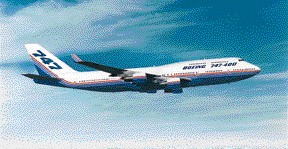 I currently fly a Boeing 747-200F. I work for a cargo airline that contractsits services to other airlines and independent companies worldwide. We have two ancient,non-digital ADF receivers in the 747 that I fly primarily, and we use them extensively,particularly when flying the Zipaquira One SID out of Bogota, Colombia. Night. Mountains.Lousy air traffic control. Bad weather. We pay very close attention to tuning andidentifying those four NDB’s when climbing out of Bogota at our maximum runway-limitedtakeoff gross weight. Trust me on this.
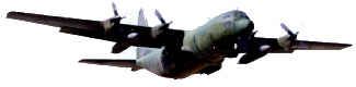
Prior to checking out in the 747, I flew the civilian version of the Lockheed Hercules,the L-382. The Herc is a special-purpose aircraft. Originally designed by Lockheed as amilitary assault transport, the civilian derivative is the world’s greatest bush plane. Ihave landed it on road sections, taxi strips, and runways carved by machete-wieldingtribesmen out of the African bush. I have landed it repeatedly on a one-way dirt strip inthe central highlands of Papua New Guinea, after having shot an NDB/DME approach through athick stratus layer into a valley carved by one of the world’s most scenic lakes. NDB/DME,you ask? In PNG, that’s what they use to let down into blind valleys at night. Better knowthose ADF procedures, folks.
 During the eight years that I flew the Hercules, my company, Southern AirTransport, was extensively involved in various African relief operations sponsored byseveral international relief organizations. Among the many were The InternationalCommittee of the Red Cross, Caritas, UNOSOM, UNDRO, the the Lutheran World Foundation, andMedicines Sans Frontires. I had many opportunities, most assuredly not always-welcomedopportunities, to return to the basics.
I used GPS on a limited basis in Africa a few years back while flying Lockheed Hercs onrelief missions, particularly in the southern Sudan. We were required to locate bushstrips or drop zones near small villages in what may be described as a "tracklesswaste" where pilotage was difficult due to the similarity of many terrain featuresand the additional problem of potentially being hit by ground fire if we flew too low. Weused a handheld Garmin GPS receiver to supplement the Omega systems that were installed inthe Hercs at the time, because Omega was occasionally incredibly inaccurate.
In this day and time of positive control, Class A & B airspace, and the ubiquitoustransponder, it seems to me that much of the freedom has disappeared from flying. Thatdoes not negate, however, what I feel to be the absolute necessity of initially learningthe basics of all forms of navigation when acquiring the skills that will set thegroundwork for a lifetime career in aviation.
Admittedly, we no longer have to fly along reading the signs on water tanks andfollowing railroads to locate a small grass strip out in the hinterlands. I often did thatas a kid flying around the northern Gulf of Mexico. It was fun, and it insured that Iwould have to really work hard at getting lost. (Which I occasionally did, anyway.)
All those years ago —I soloed July 4th, 1959 at Bates Field in Mobile, Alabama at age16 — I never contemplated that I would find myself some thirty-three years later tryingto read a GNC chart while ensconced in the command seat of a Lockheed Hercules, eighteenthousand feet over southern Angola, looking for the town of Ongiva. Problem was, I had twoOmega receivers in the airplane, and they had each led me to a different airport. TwoOmegas; two airports; two towns.
Why not just get a VOR fix? What’s a VOR? You won’t find them in a country that hassuffered from twenty years of civil war, where "rebels" held half thecountryside, and where, in those days, the only functioning instrument approach procedurein the entire country was an ADF approach into Luanda that worked, most of the time, whenthe power was on.
So, which airport was Ongiva? I had no way of knowing precisely, based on theinformation that the Red Cross Project Manager had given me. He’d said something like,"Just go on down there. You’ll figure it out." This was Africa, not Ohio, andthis was normal procedure. If you can read a map, find the neighborhood and nobody shootsat you, you are very likely in the right place.
Had I had a functional GPS in the cockpit, it would have simplified the mattertremendously, assuming that it hadn’t shorted out because it was packed with West Africandust, assuming that no one in the area was jamming the signal, assuming that theelectrical bus powering it hadn’t popped all three circuit breakers, or assuming that noone had stolen it the night before.
So, all those years ago when my first flight instructor, Walker Taylor, insisted that Ilearn how to successfully arrive at Point B without using anything but a compass, asectional chart, and a watch, he insured that I could pretty much be assured ofsuccessfully locating Ongiva, Angola, thirty-three years down the road. And I did.
Almost every wide-eyed kid who starts out these days learning to fly hopes that he orshe will end up in the business end of a high-tech near-mach cruiser, staying at the besthotels, flying the hot international routes, visiting Paris, Rome, London, Buenas Airesand Tokyo.
Truth is, many things happen and we aren’t all Flag Carrier material. Many of us end upout in the toolies in some third-world "country" flying marginally-maintainedaircraft, trying to avoid hostile ground fire, malaria, dengue fever, dysentery, wild-eyedsixteen-year-old Somali machine gunners, and occasionally shooing green mambas and camelspiders out of our tents while keeping a weather eye out for the wayward hyena.
I suppose that in a perfect world, knowing the difference between true and magneticnorth won’t matter much. But down the bumpy road of life, there are many potholes. Theremay come a day in the distant future when the ability to remember the basics and shoot afixed-card NDB approach to minimums, or read a GNC chart and figure out just what thatsquiggly little line that bisects that river bed at the blown suspension bridge means,might just save your behind.
Fred Moore
Captain
Southern Air Transport
