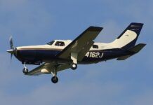
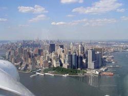
Clear day view, East River corridor at right The pilots in the Cirrus had reportedly been on a sightseeing flight in the area. They had taken off from Teterboro Airport, six miles west of New York, in nearby New Jersey, just 23 minutes before the crash. Weather indicated a ceiling at 1500, with visibility 8 miles in drizzle. The airplane circled the Statue of Liberty then headed north up the East River. The VFR airspace beneath the Class B follows the river at 1100 feet and below, ending (dropping to the surface) north of the crash site. The VFR airspace in that area might be described as a box canyon with a roof. The corridor (and river) is roughly 2,000 feet wide, contains five bridges, Roosevelt Island, has tall buildings on both sides and often includes helicopter and sometimes seaplane traffic. Winds were reported ENE at 13, with gusts to 22. Witness reports suggest that the airplane had made a u-turn to the left from a northern heading. The aircraft hit the north face of the building, at about the 40th story, and broke apart. The Manhattan landscape one block north of the crash site includes two tall buildings to either side of the Belaire — one closer to the river, one farther.


