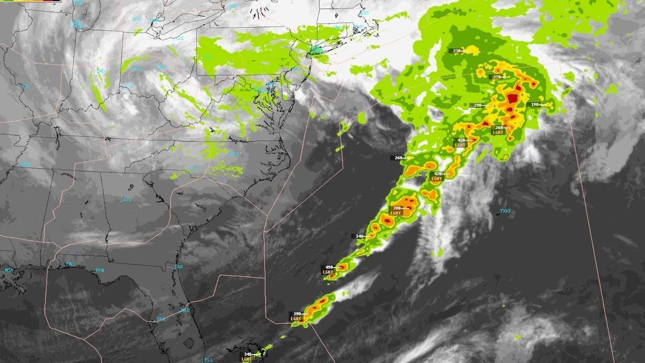
The FAA is continuing to develop and expand its Offshore Precipitation Capability (OPC) system, which uses machine learning and image processing to estimate precipitation intensity and echo top heights in areas where Next Generation Radar (NEXRAD) is not available. While not as precise as radar in identifying the location and intensity of precipitation—although with greater than 90-percent accuracy it’s close—OPC is a significant step up on simply relying on satellite imagery in areas not covered by radar.
“We don’t have radar offshore; it doesn’t reach far enough into the ocean to see, basically, so we have to come up with another method to depict where precipitation is,” said Randy Bass, a certified consulting meteorologist and manager of the FAA’s Weather Research Branch. As Bass explains in the video below, OPC creates displays similar to radar by merging satellite, model and lightning data. The next step, says the FAA, is familiarizing controllers and planners with its capabilities. Further development plans for OPC include 12-hour forecast capabilities and a global version the system.
OPC is currently only being used as a situational awareness tool for controllers at the Houston, Miami, Puerto Rico and New York centers, although the system saw some unplanned primary use last year when Hurricane Maria destroyed the NEXRAD site in San Juan, Puerto Rico. OPC was developed by the FAA’s Aviation Weather Division and MIT Lincoln Laboratory.


