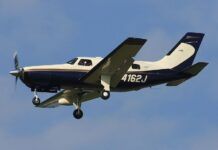
Mackinac Island, Mich., is located in the Straits of Mackinac between the state’s Lower Peninsula and Upper Peninsula. It is a beautiful island that attracts many visitors during the tourist season from April through October. Many of those tourists fly their own aircraft to the island to enjoy the many activities that are available there.The convenience of being able to fly to the island is offset somewhat by the lack of services at the airport, so most pilots fly directly to the island and plan for a fuel stop at one of the nearby airports on the return leg. There are a number of airports within a 10- to 15-minute flight of Mackinac where fuel is available. However, it gets touchy when the weather is not VFR.On a Saturday in September 2001, the pilot of a Piper Seneca departed Pontiac, in Southeastern Michigan, for the Mackinac Island Airport (KMCD). He had six others onboard, including three small children. The flight to Mackinac Island was uneventful and the group spent the evening and the following morning enjoying their stay.Before departing in the early afternoon, the pilot used the computer terminal in the airport’s lobby to check the weather. He would later tell investigators that the weather was reported as a few clouds at 300 feet, broken clouds at 1,000 feet to 3,000 feet and the visibility was three miles. He filed an instrument flight plan for the 10-minute flight from KMCD to Pellston, Mich., (KPLN), 19 miles away.The NTSB report states that the pilot “figured the people, baggage and fuel for the trip and determined that there would be enough fuel to fly from Pontiac to Mackinac Island, and then from Mackinac Island to Pellston, Michigan.”
No Luck At Pellston

NTSB transcripts of radio communication show that the Seneca pilot picked up his clearance from Lansing Radio at 1:50 p.m. and departed KMCD a minute later. He contacted Minneapolis Center at 1:53 p.m. and advised the controller that he was flying the 090 assigned heading and climbing to 4,000 feet. The Minneapolis controller cleared the aircraft direct to Pellston and asked him what approach he would like. “I don’t really care,” was the reply. “What has everybody else been using over there today?”The controller advised that the ILS was the approach in use and the Seneca pilot said, “Yeah. We’ll go ahead and take the ILS then.”The controller cleared the aircraft to the BURET outer marker via direct to the Pellston VOR, then outbound on the 131 degree radial to join the 16 DME arc and the localizer and to maintain 4,000 feet. The Seneca pilot did not acknowledge the clearance so the controller read it again. The pilot then acknowledged that he was cleared to the outer marker and to maintain 4,000 feet. He did not read back the routing.At 2 p.m. the pilot asked for a lower altitude but the controller told him that she needed him on the localizer before she could issue it. The pilot acknowledged that transmission.Seven minutes later the pilot told the controller that the localizer was coming in. Since the Seneca was below Center’s radar coverage, the controller asked, “N2JW, roger. And you’re joining up on the localizer from the arc?”The pilot said that he understood the clearance was direct, and that he was coming down on the southbound heading. The controller explained the routing she issued. Then she told him to maintain 3,000 feet until he was established on the approach and that he was cleared for the ILS approach to Pellston. She told the pilot to report established on the localizer. What is not clear is how she intended that the aircraft get to the approach from its present position, as there was no procedure turn. Perhaps she intended that the pilot intercept the Pellston 16 DME arc to the localizer.Once again the pilot did not read back his clearance except to say, “Down to 3,000.” Thirty seconds later he told the controller that he had just flown through the localizer.The Center controller who, up until then, did not have the aircraft in radar contact, said, “N2JW, I think I’m getting a hit on you now. You’re about five miles south of the outer marker. I can vector you for the localizer but I’m gonna have to climb you to 6,000. Do you want to do that?”The pilot responded, “That’s fine. I am gonna tell you I’m … I’ve got a low fuel status at this time, so if you could make it quick that would be great.” The controller cleared the aircraft to 6,000 feet and issued a vector of 090 degrees. After a few more vectors and a descent to 3,000 feet, the controller cleared the pilot for the approach.Five minutes later the pilot came back up on the Minneapolis Center frequency and advised that he had gone missed. The controller asked him to say his intentions. The pilot responded, “I’m very low fuel. I need to get down.” “N2JW,” the controller said, “how would you like to get down?”[Are] there any other airports reasonably close reporting good visibility?”
Dwindling Options

300
Things clearly weren’t going well for the pilot. He had just gone missed and was already low on fuel.For the next 10 minutes or so, the pilot flew around heading to different airports as he weighed his options. First, he elected to go to Charlevoix, bypassing Harbor Springs, which was closer. When the controller told him the Charlevoix NDB was reported out of service, another pilot on the frequency suggested Gaylord, 35 miles away, and the pilot said he would go there.At 2:22 the pilot of 2JW declared an emergency, telling the controller that he now had an engine out. “N2JW, roger,” the controller replied. “I do understand there’s an engine out. The Harbor Springs Airport is just southeast of your position by about eight miles.” The pilot said he couldn’t talk, but he came back a few seconds later and reiterated that he had lost one engine.”Do you want to still take the heading for Gaylord, or what would you like to do?” The controller asked.”Ah, yes. Get me down,” was the response.At 2:24 the controller said, “Do you want to try Pellston again? That’s the closest airport with an ILS. I’m showing [it at] two miles. There’s heavy rain [and] the ceiling’s 800 broken.” The pilot said he’d try Pellston again.A few minutes later, the controller asked the pilot if he had the approach plate for Harbor Springs. The pilot said he didn’t have enough fuel to get there. The controller told him that Harbor Springs was at 12 o’clock and about eight miles. “They have an RNAV Runway 10 approach. You’re almost practically set up for it.” The pilot responded that she would have to read the approach plate information to him because he didn’t have the time to retrieve it. But a few seconds later he said, “We’ve got Harbor Spring,” apparently meaning that he had located the approach plate.At that point the controller told him that the Harbor Springs Airport was at 12 o’clock and five miles. The Seneca pilot responded that he was going to need help inputting the information into his RNAV unit. “I can’t do it and fly the plane,” he said.At 2:30 p.m. the pilot told the controller that he didn’t know what the frequency was for the approach and that he was too busy flying. The controller responded that he was going to have to put the information into his RNAV system or go to Pellston, because there was no navaid associated with the approach itself. A minute later the pilot said he had the information in the unit. The controller read him the inbound heading and MDA for the approach, but the pilot reported, “It’s not in my system. I need to go back to Pellston.” Then, the controller told the pilot that she had a pilot who could help read the approach plate to him if he still wanted to try for Harbor Springs. The pilot responded, “Talk me down.”Another controller came up on the frequency and began talking the pilot through the approach. At 2:34 p.m. he asked how much fuel was left onboard. The pilot responded, “Ten minutes.”The controller told him that he was directly over the Harbor Springs Airport, and that the cloud bases were reported at 1,300 feet. He said he was going to take the airplane around the procedure turn and back to the airport.
Out Of Time

At that point the pilot told the controller that he had lost his second engine. The controller told him to establish his best angle of glide and to fly a heading of 310 degrees for the airport. When the pilot was established on the heading the controller told him that the airport should be at about his 11 o’clock position. The Seneca was at 2,000 feet at that point. “If you see all water you want to start a slow turn back to the left to look for the airport,” the controller said.At 2:38 p.m. the pilot reported that he had the ground in sight but did not see the airport. He said he was going to land on the shore. There were no more transmissions from the aircraft.In his report to investigators the Seneca pilot said that when he was clear of the clouds he was about 300 to 400 feet above the water. He said he could see the shoreline to his left and made a 30-degree turn towards the shore. He put the landing gear down, though he said he probably should not have, and landed the airplane in shallow water. The airplane flipped during the landing, but there were only a couple of minor injuries. After the pilot and the passengers had exited the aircraft he called Lansing Flight Service to tell them that they were all safe.In his statement to the NTSB, the pilot stated the controllers caused some of the confusion. He said the Center controller initially told him to fly directly to the Pellston outer marker and that resulted in his flying a 90-degree intercept to the localizer. He said he went right through the localizer. Then, she told him to climb to 6,000 feet for vectors back to the localizer and he found himself two miles from the outer marker at 6,000 feet. The published glide slope intercept altitude is 2,500 feet.He said he dropped the gear and pulled the power back to idle. He said the glide slope was coming in, but “it wasn’t right,” so he made a missed approach. During the missed approach his wife told him she saw the runway. He was at 1,200 feet, almost 300 feet above DH when he broke off the approach.The pilot held a commercial license, and while he wasn’t exactly a high-time pilot, he wasn’t completely inexperienced, either. He had flown quite a bit in the past 90 days and had logged almost 100 hour of instrument time. It appears that he handled the engine failure well, shutting down and feathering the engines as they quit.There is no question from the transcript that the controller told the pilot twice to fly the Pellston 131-degree radial outbound to intercept the 16 DME arc and then the localizer. The pilot never did acknowledge the entire clearance. The NTSB report doesn’t indicate if the pilot knew that in the vicinity of Pellston, Minneapolis Center radar coverage is limited, which is why the controller had him climb to 6,000 feet for vectors to the airport. The climb cost the pilot time and fuel.In his statement to investigators the pilot said that he would have liked a second chance at Pellston, because his wife had reported seeing the airport as he made the missed approach, but he never asked for that, according to the NTSB report. The controller asked him, “How would you like to get down?” and he asked if there were any other airports reporting good visibility. That’s what seemed to set up whatever confusion there was during the rest of the flight.There is no forecast information in the accident report, but the weather at Pellston just as the airplane was landing on the shoreline was wind from 010 degrees at 4 kts, four miles visibility in light rain and mist, a ceiling at 800 feet broken, another layer at 1,500 overcast, and the ceiling was reported as variable between 600 and 1200 feet.The NTSB accident report provided no information about legal alternates. It’s not known if the pilot had filed one and if he had, whether it was reachable given the fuel available. For a 10-minute flight, most of us don’t think much about alternates because we seldom need them. But if the weather is a factor, alternate planning is a must.There are many things that can happen even on a short flight that can affect the pilot’s ability to get the plane safely on the ground: mechanical issues, weather, air traffic delays. Being tight on fuel can obviously aggravate the situation if the flight isn’t going as planned. Fuel translates into options, and if you don’t have much of the former, you automatically have less of the latter. ATC can sometimes help or hinder the situation but, in any case, an IFR pilot should be assertive in requesting any kind of assistance.By the nature of what we do, we tend to put a great deal of faith in controllers. But we have to remember that ultimately the pilot has to decide what the best course of action is. Obviously, fuel planning is always a challenge but especially so when most or all of the airplane’s seats are occupied. In some circumstances, due to weather and the need for alternates, the best choice may be to simply sit it out and wait for improved weather. And when trying to get into an airport at or near minimums, there’s nothing wrong with attempting a second approach if the likelihood of success is high.The NTSB blamed the accident on the pilot’s inadequate preflight planning, his improper in-flight decisions, and the unsuitable terrain for landing. ATC personnel also were found to be lacking in that they provided “inadequate” service.
More accident analyses are available in AVweb’s Probable Cause Index. And for monthly articles about IFR flying including accident reports like this one, subscribe to AVweb’s sister publication, IFR Refresher.


