Image: NOAA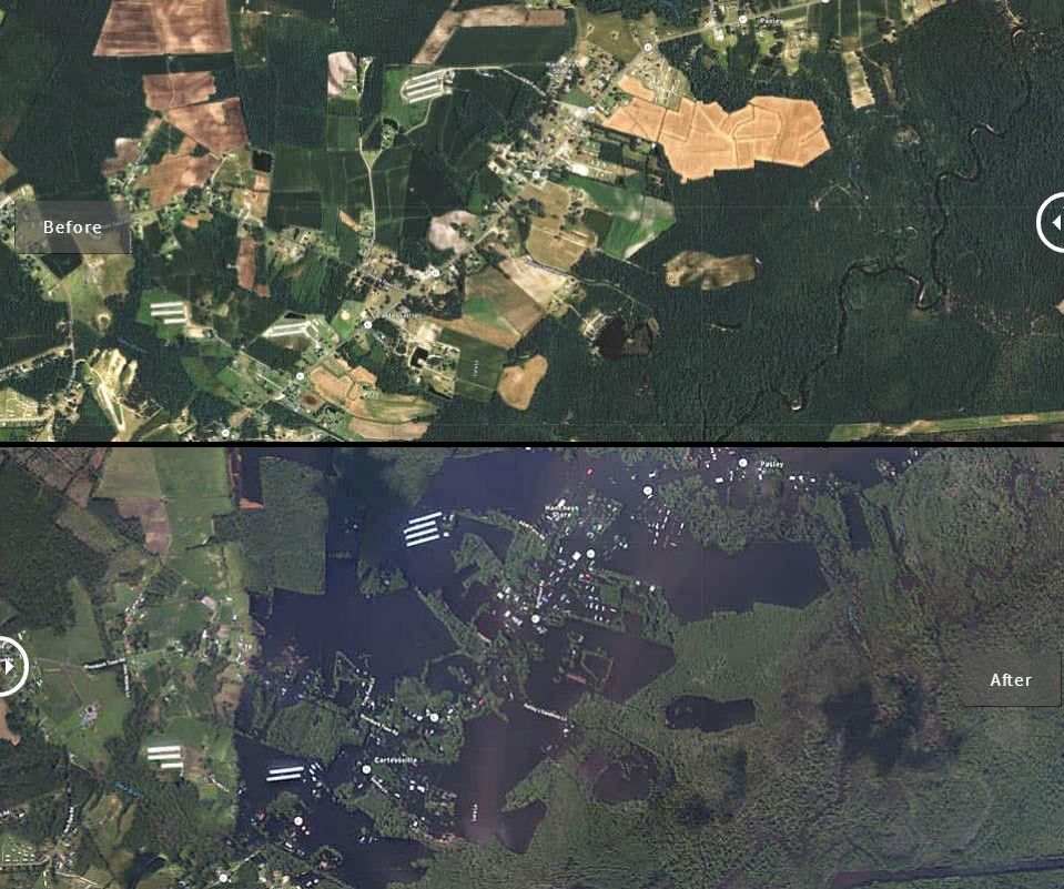
The National Geodetic Survey (NGS) Remote Sensing Division is working to collect aerial imagery of the damage caused by Hurricane Florence in the last week. Depending on weather conditions, NGS has been attempting two survey mission a day to locations identified by the National Oceanic and Atmospheric Administration (NOAA), Federal Emergency Management Agency (FEMA) and other state and federal organizations since Saturday. The images collected from the flights will be used for damage assessment and are available on NOAA’s website.
“Aerial imagery is a crucial tool to determine the extent of the damage inflicted by flooding, and to compare baseline coastal areas to assess the damage to major ports and waterways, coastlines, critical infrastructure and coastal communities,” said NOAA. “This imagery provides a cost-effective way to better understand the damage sustained to both property and the environment.”
For the mission, NGS is flying the NOAA Office of Marine and Aviation Operations’ King Air 350CER. According to NOAA, the special-mission aircraft has been modified with two downward-facing sensor ports that can support a wide variety of remote sensing systems, including the cameras used to map the hurricane damage. It also has extended-range capabilities and can remain aloft for up to eight hours. The administration says the aircraft is primarily used for coastal mapping and emergency response missions.


