Roundtable: To (VHF) Nav or Nav Not
Technologies develop, sometimes slowly over time, with the kind of sloth that makes you wake up one day, see an evolved landscape, and question your strongly held beliefs. Such as:…

Technologies develop, sometimes slowly over time, with the kind of sloth that makes you wake up one day, see an evolved landscape, and question your strongly held beliefs. Such as: For any airplane you’d consider flying in instrument conditions, at least a modicum of redundancy is required. We used to want fully distributed systems to back up our electronics, but now we accept a certain degree of internal redundancy because the technology is so mature.
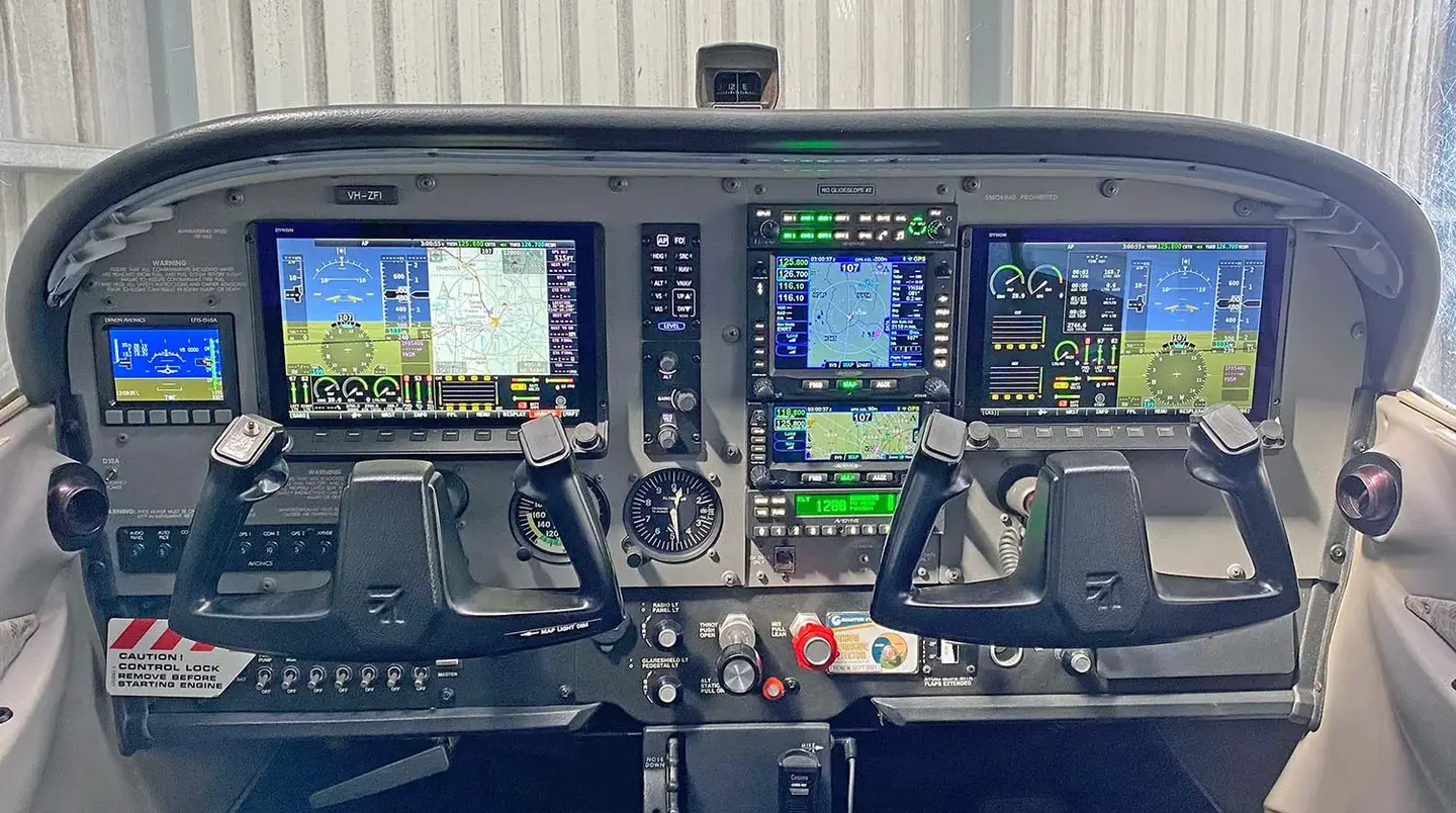
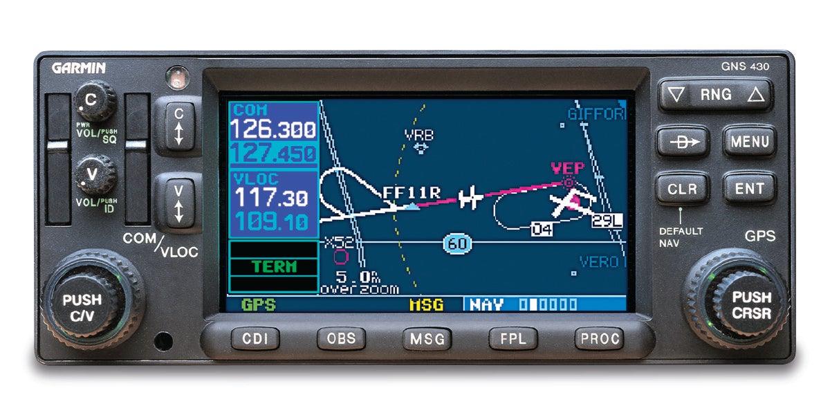
And now builders of Experimentals are grappling with this: Thanks to the proliferation of GPS approaches and the high quality (read: reliability) of GPS navigators on board, can we simply do without the VHF nav portion for IFR flying? Doing so means you can’t tune in a VOR, or fly a localizer or ILS approach natively. With an IFR-approved GPS you can, of course, fly many of the same procedures with, some would argue, better accuracy and greater smoothness in the signal. And, obviously, omitting a VHF nav receiver can save money and installation time, though you’d be wise to up your game on the GPS side if it’s your main navigation source. Truth is, though, you probably have multiple GPS sources on the airplane, some serving as part of your ADS-B In data path.
But does it make sense? We asked around “the office” for opinions. Not surprisingly, our staffers and correspondents were only too eager to oblige.
Myron Nelson
KitPlanes Contributor
Aircraft: Van’s RV-10, Boeing 737
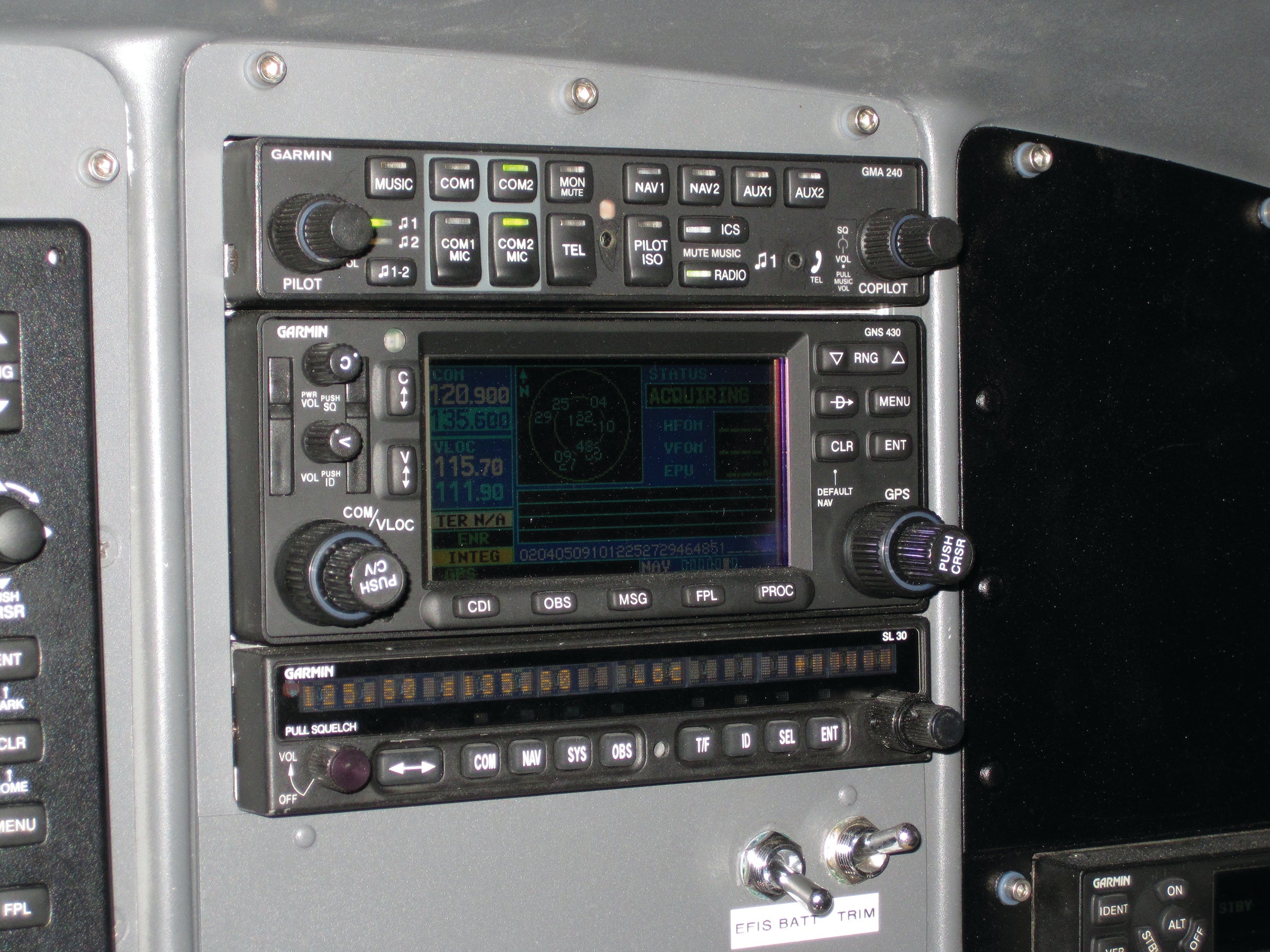
If the aircraft in this discussion is the type for serious cross country, and the owner plans to either acquire an IFR rating and/or maintain IFR currency, then my position is an emphatic yes to nav, with the caveat of equipping it smartly. By smartly I mean not sinking a bunch of money into it. For my RV-10 project, I bought a used Garmin GNS 430W, which gave me a second com, a backup GPS, and VHF nav for a level of investment that essentially gave me the nav capability for cheap or even free on top of other things that I wanted anyway.
Here are my arguments for being in the pro-VHF nav camp for a serious cross-country machine, and it starts at the top of the food chain (airliners) and works its way down.
It is said that the golden rule is “he who has the gold…makes the rules.” When it comes to civil airspace, airliners rule the roost. It may surprise some to find out that large transport-category airliners don’t use GPS for primary en route navigation and have only been equipped with GPS for the last few years, long after it was common in general aviation. Airliners (and most military ops) use inertial navigation, which is internal (doesn’t need ground signals nor satellites to operate) and way too complicated and expensive to work its way down to general aviation except at the highest levels. Most airliners also have GPS installed, but its role is primarily backing up, fine tuning, and cross checking the IRS systems, along with VHF nav (VOR/DME), which performed that IRS refinement role before GPS. Incidentally, while the concept is called an inertial navigation, or INS, the boxes themselves say IRS, for Inertial Reference Systems.
The lowest approach minimums available to most airliners at most commercial airports are still based on ground-based ILS. It has been that way for decades and could very well continue for decades to come. The technology is proven effective, well known, universally equipped, and cost effective.
As long as the foundation of airline instrument approaches remains VHF ILS approaches, the schools teaching future airline pilots will be teaching it, and the manufacturers of their training equipment will accordingly be equipping their wares with that technology. All of this makes a chicken/egg vicious cycle omelet that should keep the VHF technology in place for many years to come. VORs may drop off the map, but ILS installations show no such retreat. GPS will never completely take over the airspace until it takes over airline operations, and there are no signs of that happening anytime soon. If ever.
Then there’s the “eggs in one basket” argument. Ever since there has been such a thing as an IFR aircraft, there has always been an emphasis on separate and distinct technologies backing each other up. By its very systemic “netlike” nature, there is no backup if the system you rely on can be completely or partially shut down with the flip of a switch by either friend or foe, as GPS can. I’ve seen it happen several times in the airline world. Often, but not exclusively, in the White Sands New Mexico area, where the signal simply quits. (I’ve been told that they are testing their ability to shut it down and/or tweak with the system, but I’ve never been told who “they” are.) Sometimes the outages are pre-announced by NOTAM. Sometimes not. Sometimes the controllers are aware, sometimes not. It can be for a few minutes or a few hours. (As I was writing this, the U.S. Navy announced a broad GPS signal degradation/jamming test affecting several states in the southeast right when hundreds of aircraft would be relocating for hurricane Dorian, prompting AOPA and other advocacy groups to file official protests.) Losing coverage over a broad area is a much different level of “loss” than one isolated frequency going down at one particular runway.
The universality of GPS becomes its Achilles’ heel. The standalone individuality of each VHF installation becomes a de-facto advantage.
With all that in mind, here’s my take. For a simple VFR short-hop pleasure craft, VHF nav probably isn’t worth the investment. If prospective builders are considering a serious cross-country travel machine and obtaining an IFR ticket or maintaining IFR currency, then I am solidly in the camp of cost-effectively installing VHF nav capability. It doesn’t have to be expensive and it can be at the very least useful, and perhaps even lifesaving for many years if not decades to come.
Stein Bruch
Owner, Stein Air
Aircraft: Whatever you’ve left for him to work on...
There are a couple of different ways to interpret “need” in regards to nav receivers in an aircraft. Much depends on how else the aircraft is equipped and how the aircraft is to be utilized. Let’s look at a few variables without getting into the weeds regarding IFR requirements for filing, alternates, approaches, etc. This entire discussion also changes dependent on country of certification as well.
Let’s say you have two certified GPS sources—either standalone or one of the newer combo Garmin boxes. In that case you could easily say you don’t need a nav radio. You could easily punch up and down through layers and go about your merry way. Depending on airport approach scenarios, you may or may not be limited as to options. The point here is that need is relative.
An alternate version of need comes into play when you operate at an airport with no (or limited) GPS options for approaches or communication. Such airports do exist. Lastly, there might be times when you fly into an airport where there is information broadcast or exchanged over a navaid frequency (FSS, HIWAS, or AWOS). In that case, need becomes much different if it’s the only way to interact with those various pieces of information.
There is much online debate among pilots about whether VORs are disappearing or not.
To that end, the FAA has a program in place called the VOR MON (VOR Minimum Operational Network), which aims to keep a number of VORs around for years to come. Their reasoning states: “The VOR MON is designed to enable aircraft, having lost Global Navigation Satellite System (GNSS) service, to revert to conventional navigation procedures. The VOR MON is further designed to allow aircraft to proceed to a MON airport where an ILS or VOR approach procedure can be flown without the necessity of GPS, DME, ADF, or Surveillance. Of course, any airport with a suitable instrument approach may be used for landing, but the VOR MON assures that at least one airport will be within 100 NM.”
The following bullet points are included in the FAA data:
- Retain VORs to perform Instrument Landing System (ILS), Localizer (LOC), or VOR approaches supporting MON airports at suitable destinations within 100 nautical miles (NM) of any location within the CONUS. Selected approaches would not require Automatic Direction Finder (ADF), Distance Measuring Equipment (DME), Radar, or GPS.
- Retain VORs to support International Oceanic Arrival Routes.
- Retain VORs to provide coverage at and above 5000 feet above ground level (AGL).
- Retain most VORs in the Western U.S. Mountainous Area (WUSMA), specifically those anchoring Victor airways through high elevation terrain.
So, as Myron says in his segment above: VORs will not completely disappear soon, and there may be situations when a VHF nav receiver is the only way to conduct the approach. These cases are fewer every day but that number is not (yet) zero.
Paul Dye
Editor at Large, KitPlanes
Aircraft: RV-8, Tundra, SubSonex
Just for perspective, I learned to fly in a hand-propped J-3 Cub. Navigation was a pencil line on paper maps, a wrist watch, and looking out the window—and hoping that the map didn’t get blown out the open door! In order to meet the private pilot requirements, I had to rent a big, fancy VOR-equipped Cessna 150 (not even a 152!) for a couple of hours to demonstrate my ability to track radio waves. Yeah…it was a long time ago.
So take that into account when you think about my contribution to the often-debated question on “children of the magenta line.” If GPS is good enough these days, do we still need people flying with VORs? My position: Well, heck, if you can’t fly an NDB approach, what kind of a pilot are you anyway…and geez, if you don’t know how to fly an A-N Low Frequency range to minimums, won’t Ernie Gann be rolling over in his grave?
Seriously? Well, no…I’m just kidding around with those guys. But there is a little truth in all good-natured ribbing. Pilots who think that “these kids really don’t know what they are doing if they can’t fly with a VOR” are stuck in a limited way of thinking. Technology always advances, and what we think is cheating today is going to be the old way of doing business in just a few years. Honestly, I’ll take all the help I can get when it comes to determining my position in space, and right now GPS is a magic way of doing that, one that beats the heck out of twiddling knobs and reading dials to visualize my location on a map.
(Now before anyone thinks I’m really ancient, let me point out that I had an opportunity years ago to fly one of the few operational Link trainers from way back in the day—and that is where I flew those LF Range approaches—never had to do it in anger, in the ice, at night, with an evil captain lighting matches under my nose.)
The truth is, GPS has revolutionized navigation on land, sea, and air. No longer do we have to interpret arcane readings and come up with a position on a map—the electronics do that for us, and essentially flash a message with an arrow that says, “you are here!” And if the map you like to use dies, you can bring it up on another display, or on your tablet…or on your phone. Counting up the GPSes in my single-seat VFR cockpit, I have to use the fingers on two hands, that’s how redundant we are these days. No, I am not worried about losing the capability to look at GPS data.
Ahhh…but what if all the satellites go away? Sure, with nothing but GPS, we are putting all of our eggs in a single basket. But if we are to trust the FAA’s plans for NextGen, everything in the air will be dependent on GPS for traffic flow and separation in just a few years. It has to work, or airliners are going to be bumping in to one another. Someone at the agency is going to have to knock on the Pentagon’s door and remind them that the days of spoofing have to end. If that doesn’t happen, then all bets are off. So let’s assume that GPS is going to be pretty reliable—not because of us lowly personal fliers, but for the millions of airline passengers around the world. And the auto industry. And the trucking industry. Not to mention the world of delivery drones. As they say: Follow the money.
So let’s say I build my next airplane sans VHF nav. (Full disclosure: I built my latest project, the little jet, without it already.) Am I worried about filing and flying IFR with it? Well not really. I have plenty of faith in the GPS network, the approaches are everywhere I want to go, and even if the minimums are higher, I don’t file and fly anything where I have to fly to ILS minimums to get back on the ground. Yup, I allow plenty of fuel to fly to a great alternate, that’s just how I manage risk. If the GPS constellation gives up, I can still ded-reckon to get to somewhere with good weather, and I always have a working com radio to ask for vectors.
Anything can fail. But GPS is probably the last thing that will go down when we catalog the various technologies that help us determine position. There’s nothing wrong with wanting to put VHF nav in your airplane if it makes you feel better. But admit that you’re adding a much less reliable system, and make sure you practice with it.
And if, like most homebuilders, you’re just going to fly VFR, enjoy your GPS device, and don’t forget that you can always look out the window and use a chart. Even if it is on a tablet, it’s still a map.

Larry Anglisano
Avionics Tech/Editorial Director
Aircraft: What You Got?
Heck, if I was putting together a kit from scratch, I’d skip the VHF nav just so I didn’t have to install the dang antenna system. Good antennas have always been pricey, but a quick browse of the antenna section in the Aircraft Spruce catalog proves they’re more expensive than ever. And, no, you can’t connect the VHF nav receiver to the communications antenna.
If you were installing, say, a VHF nav-equipped Garmin GTN 650, one option would be the Comant CI-158 series. It’s a V-style dipole that covers the 108-118 MHz spectrum for VOR/localizer reception and 329-335 MHz for receiving the ground-based glideslope signal. For shy of $400, the flavor that has a four-hole mounting configuration doesn’t come with cable or connectors, has a built-in ferrite balun for better radiation and mounts to the top of the vertical tail. A version with desirable fiberglass elements is even pricier. Unless you go with an internally mounted antenna or something built into a fairing, the airframe is just a heck of a lot cleaner without a dipole sticking off and simply requires less upkeep.

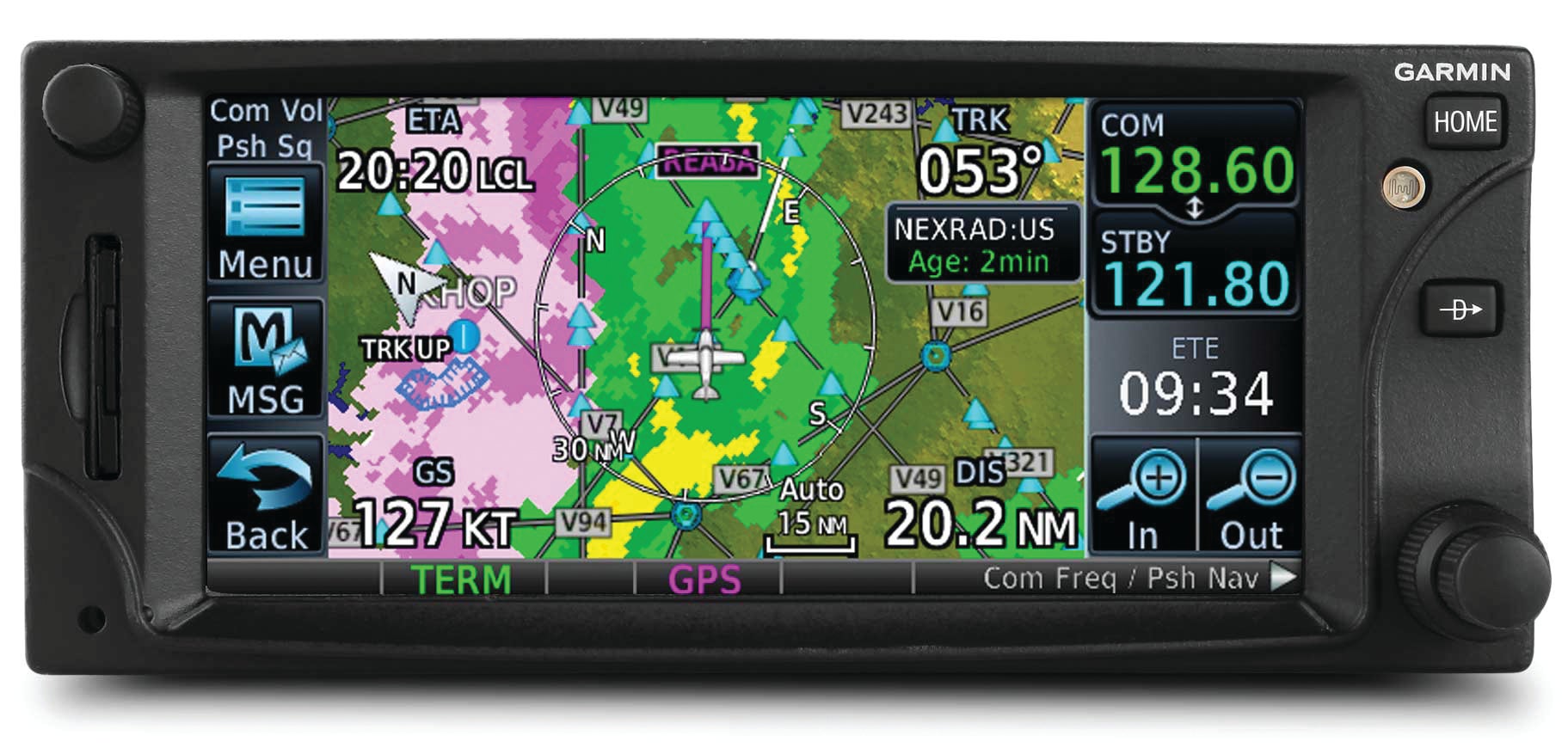
Antenna installation complexity and maintenance aside, it’s easy to vote the buy-in decision with your wallet. The price delta between an all-in-one navigator with VHF nav and Garmin’s latest IFR GPS units without VHF nav is significant. The GTN 650 is $11,995 (plus com and nav antenna system) and the GNC 355 GPS/com is $6995, plus com antenna (the system comes with a WAAS GPS antenna).
If you fly mostly VFR, the decision has already been made for you, in my estimation. Forget the VHF nav and fly GPS all the time every time. If you hit the clag on a regular basis, well, you have some decisions to make. In a lot of cases VHF nav might be used to back up GPS. In some parts of the country NOTAMs for GPS interference are a regular thing and should have you dialing up the closest VOR just in case. But face it, if the GPS went out, the chances of a controller helping you get where you need to go en route is pretty likely if you didn’t have that scalloping VOR needle to chase—even though good instrument pilots don’t chase needles.
As for approaches, given the choice of a VOR or even LOC/LDA approach versus the typical GPS approach, I’d put money on most GA pilots choosing the GPS approach every time. Adding LPV precision minimums on GPS approaches brings the tight comparison to ILS versus LPV, allowing the majority to disregard VOR and LOC approaches altogether. A VHF-based ILS and a GPS-based LPV approach usually get you down to the runway with the same minimums. If you have an autopilot with GPS steering, I’d bet even more money on the majority loading the GPS so the autopilot can fly it with precision.
The way I see it, with over 1500 Category I ILS approaches compared with almost 4000 GPS RNAV approaches with LPV minimums (and many more with higher minimums) there’s less operational advantage to VHF nav than ever before—either en route or on approach. Of course, that’s as long as the GPS keeps working when you need it the most. If you’re worried that it won’t, you’ll have to shell out lots more money for old-school VHF nav as backup. But thanks to those new boxes from Garmin, at least now you have a money-saving choice.
Marc Cook
Editor in Chief, KitPlanes
Aircraft: VFR (For Now) GlaStar
I’m going to play the practical card while I explain what I would do: Forget the VHF nav and side with the GPS-only crowd. Yes, I know I’m putting my ability to get back on the ground into one box, and that one box could break or brick. (Honestly, it’s never happened to me for real, but I’m also not flying every day in a Boeing.)
Here are just a few reasons why this makes sense for me.
My home base has two approaches, a localizer and an RNAV (GPS) approach to the same runway. Both have the same minimums. In this specific instance, there’s absolutely no benefit to having VHF nav here. Unless, of course, you’re of the mind that “they” will turn off the GPS signal just when I need it most.
In the event that the actual weather is below minimums for that airport, my logical alternate is a pretty good one. For me, that airport isn’t actually the closest, but it’s better suited for groundside logistics in the event I have to land there and reposition the aircraft when the weather clears. (What I really want is a ride home and a warm meal.) Even then, the likely alternate is just 23 nm away, which isn’t much fuel. There, I’ll find an ILS approach as well as an RNAV with LPV to the same runway; both have 200-2 minimums. I appreciate that an LPV approach is not technically a precision approach, but from a functional standpoint, it is. As long as everything is working, my approach minimums are the same. Again, there’s no benefit to having VHF nav here.
Then there’s the way I tend to use the airplane. I’m not carrying a bunch of paying passengers who definitely need to get to Block Island or their weekend is ruined. I fly with a desired schedule in mind, but the nature of how I travel is baked in with flexibility. If “they” are going to turn the GPS off for a bit, I’ll make other arrangements. Maybe I’ll even just fly there by looking outside.
Finally, my decision is colored by my personal experience “back in the day.” I built my Sportsman with a basic panel—Garmin SL 30 and portable (VFR) GPS, plus a two-axis, non-coupled autopilot. On about the third different panel in N30KP, I had a Garmin GNS 430W driving a coupled autopilot through a pre-Touch G3X system. As soon as I had the 430W in there, I basically stopped doing VHF-based approaches, and never used VORs for en route navigation. And while my home base had equivalent approaches to the primary runway—both ILS and GPS—the alternative when the winds were strongly out of the east was best handled by the GPS. Would you rather shoot a VOR approach with minimums of 900-1 or an LPV to the same runway with minimums of 300 and 7/8mile? So, when N531CE gets upgraded for IFR flight, it won’t be by throwing a VHF nav into its circa-2002 panel.
What About Alternates?
One of the leading issues brought up by those advocating for VHF navigation equipment centers on IFR alternate requirements. The rule is actually fairly simple to say: For one hour before to one hour after your intended arrival time, the filed destination has to have forecast weather with a 2000-foot-or-greater ceiling and 3 miles’ visibility. That’s the so-called 1-2-3 rule. If your filed destination is forecast to have weather below that, you need to officially file an alternate. The standard minima for non-precision approaches is 800-2 (800-foot ceiling, 2 miles’ visibility) and 600-2 for precision approaches. You’ll note that most actual approaches have “better” minimums than that, but there are exceptions. Plus, there are approaches that aren’t approved as an alternate at all.
So, what’s the upshot? To a great extent, fuel. You need to carry enough fuel to fly to the destination, then to the alternate, then fly for 45 minutes at cruise power. Unless you can tanker a lot of fuel, having a legal-to-file alternate that is also nearby is certainly desirable. So, to see how this shakes out in the real world, it’s worth looking carefully at the approaches serving your home field as well as where you fly frequently, and run a few sample trips through the computer to see what the practical upshots are. It’s possible your alternate needs are perfectly well served without a VHF nav on board.
- Marc Cook
For more great content like this, subscribe to Kitplanes!