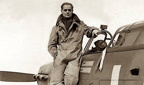
Pelican’s Perch #11:Using a Handheld GPS – IFR!
Never one to let a good idea, or safer method of flying, wither away for lack of action or misunderstanding, AVweb’s John Deakin takes on the subject of flying IFR with your GPS handheld. “Not legal,” you say? “Not so,” says John. Flying IFR with your handheld GPS is not only legal, it’s a godsend he says, and explains just how to get the most out of that handful of navigation wizardry.
 Can't do it? Rubbish!
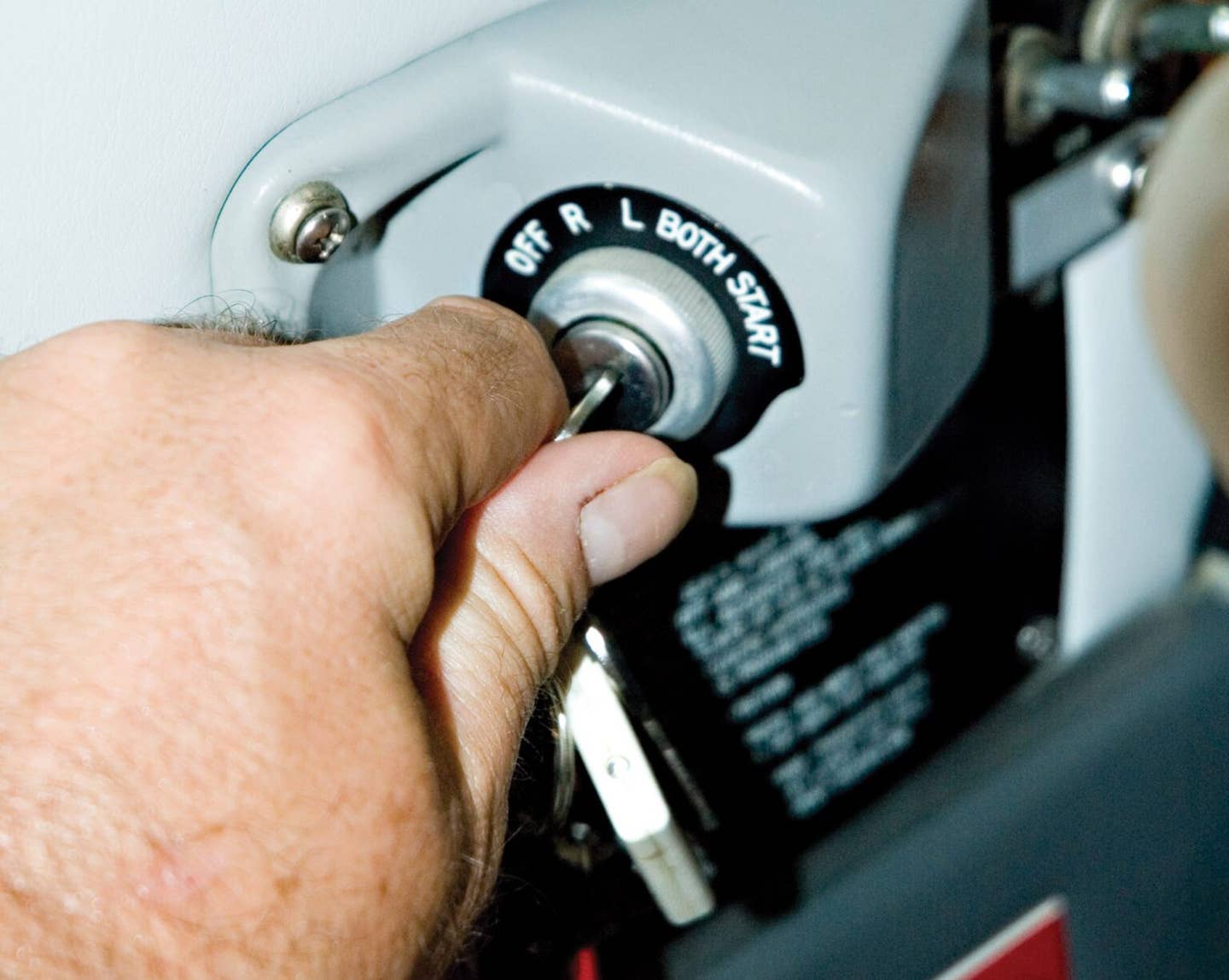
Yeah, I know, the handheld is notFAA-Approved, or TSO-129 compliant. Well, neither is a #2 pencil,but that doesn't mean you need an FAA-approved pencil (yet) towrite down a clearance, and you don't need an IFR-approved GPSto use one while IFR, either. I wouldn't be so hot on this subject,except for the fact that IFR certification has made most of theIFR-certified units less useful, and perhaps even less safe, thanmany of the handhelds! The IFR panel-mounts are much more complex,harder to use, and with far less in the way of features,and data, thanks to the difficulty and expense of getting throughthe FAA certification process.
The key to this discussion is separatingwhat you must have on board the aircraft for IFRflight, from what you actually use and howyou must use it.
The Minimalist Approach
 FAR 91.205(d)(2), which covers minimumequipment for IFR flight says "Two-way radio communicationssystem and navigational equipment appropriate to the ground facilitiesto be used."
I take this to mean that if you haveVOR and/or ADF on board for the navigation, you're covered inthe USA, provided you can reasonably use it to get where you'regoing and shoot an approach there. It doesn't say you must usethat old stuff.
Major Warning!
Note carefully, you cannot legallyfly IFR with a handheld GPS, if that is the onlynavigation device on board, and we may never be able to do that,even with fully-approved, IFR GPS.
Designators
Now that we're all used to "slantRomeo" for "Area Nav," the FAA went and changedit by NOTAM (The AIM hasn't been changed yet, at least as of August13, 1998). Now, "/R" refers to a system of trans-oceanicnavigation with very high accuracy. The new designator for "AreaNavigation" is "/I" ("Slant India"),or "/G" ("slant Golf") for an IFR-approvedGPS.
The /I designator is only used ifyou truly have an approved Area Navigation system, which can bethe old King KNS-80, or an approved IFR Loran. The /G is usedonly for an IFR-approved GPS. There are other systems, but theyare not usually found in the GA world.
What suffix do you file if you haveonly a handheld GPS, and the usual VOR/ADF? You simply disregardthe GPS, and file whatever code indicates the rest of your gear,typically DME and Transponder, perhaps /A or /U.
Some with VFR-only GPS add in the"Remarks" area "VFR GPS" or "GPS on board". This is not really necessary, but for a "with-it" controller, it does let them know you do have some additional capabilities,even if unapproved.
Flight Plan Routing
 First, I suggest you find the "PreferentialRoutes" pages, and simply throw them away forever. I findthem totally useless, antiquated artifacts of an earlier age. They are often out of date, and besides, ATC will give you "theplan of the day" anyway.
Unless I have some reason (weather,hostile terrain, etc.), I invariably file IFR from my point ofdeparture to my destination, "direct" with no intermediatewaypoints. You folks who fly in the Northeastern USA willbe having fits of giggles at this, but never mind, "direct"is a way of life everywhere else!
You will sometimes find a briefer,or an "intermediary," who believes this is not proper,and they may fuss, wanting a more complex routing. It's up toyou how hard to push this, but they are dead wrong. Both thehumans and the computers involved can handle this simple routingwith aplomb. I had this happen at Hawthorne (HHR) some time agoafter I had computer-filed IFR direct to Seattle's Arlington airport(AWO). The poor guy working Hawthorne Ground Control came backand said "LA Center says you've filed an invalid routing,and they need a more complete route." We went back and fortha bit, and finally he said "I don't have the foggiest ideawho's right here, but this guy is getting testy, suggest you contactHawthorne FSS and file a route that the computer will take."
So I called them on the radio andexplained the problem. The fellow said something (in a disgustedvoice) to the effect that LA Center didn't know what they weretalking about and came back a moment later with, "No problem,just call Ground Control again, have a nice flight." Bythe time I switched, ground had my clearance, "Cleared toAWO via radar vectors, direct, fly heading 210 after takeoff." Perfect.
It wasn't that the computer wouldn'ttake my flight plan, the person working it probably wouldn't evenpunch it in, thinking there was no way it would work.
It is a sad fact that some modernwristwatches have more (and faster) electronics than the currentFAA computers-and with a lot more storage, too. The FAA computerscan barely contain the minimum data on major airports and navaidswithin one Center's airspace, and a few other major terminalsin airspace outside their own center. As a result, if you filedirect in either direction between Arlington, Wash., and HawthorneCalif., the computers will be very confused, and will be unableto process the flight plan. For this reason, it is best to file"DeparturePoint direct Lat/Lon direct Destination",with the "Lat/Lon" being the latitude and longitudeof the destination. That way, the computer can calculate thedirection and distance from the point of departure to some pointbeyond their boundary, and it doesn't care what's next, or thatthe next point (the destination) is the same as the Lat/Lon.Stupid computers go for stupid solutions. It looks like this:
KAWO..N3355/W11820..KHHR
In the "Remarks" section,it is best to note: "Lat/Lon is KHHR." That will letthe humans who process the flight plan know what's going on.
With this, the ATC computer (or itsoperator) may not know where KHHR is, but it can find that Lat/Lon,and thus "knows" the direction of flight, which theonly thing it really cares about.
Flying "Direct"
 First, in today's real world, ATCsimply assumes that everyone has the capability to go direct anywhere,and they simply don't care how it gets done. Even if you don'tfile a suffix that indicates Area Nav, you'll sometimes get aclearance that can't be done any other way. I've even had controllersget a little annoyed when the response is "Unable Direct". Yes, yes, technically the controller is supposed to check thesuffix and not assign "direct" unless the aircraft showsArea Nav capability, but more and more, few bother and they justassume it's so. In real, practical terms, it's up to the pilotto accept or reject, which is just as it should be, in my opinion.
Another trick when asking for advisoriesis when, for example, Seattle Center asks "Where is HHR?" I'll answer "Hawthorne, California," and the next questionis sure to be, "What are the coordinates for that?"because the SEA computer doesn't know them. It is ironic thatmy handheld Garmin 195 knows where every airport, VOR, NDB, Intersection,and SUA is in the entire Western Hemisphere, plus airport dataon all of them, and terrain features, but Seattle's mainframecomputer doesn't know where HHR is. If I think the controlleris busy, I'll often just say "Aw, just punch in my destinationas LAX, and I'll sort it out with LA Center later." Usually,there is an on-air sigh of relief, and "Thanks!" Thatway the computer is happy, I'm happy, and the controller doesn'thave to punch in a bunch of numbers, so he's happy. Once I'mturned over to L. A. Center, I'll say "Destination change,Hawthorne, HHR." The only response is likely to be "Roger."
A tip on asking for advisories:remember the person on the other end is often very busy, evenif you don't hear him on the air. There may be voices or soundscoming in both ears, he may be on one or more "landlines,"and he's probably mentally juggling a lot of "stuff." The more professional you can sound on the radio, on that veryfirst call, the more likely he is to accept you. On the otherhand, if your first transmission or two is long, rambling, inno particular order, he is very likely to just say "Unable"to you, and "Squirrel" under his breath (this is nota compliment). One little procedure I like, that seems to workwell is saying, on the initial contact:
"Good Morning, Seattle Center,N1BE, VFR Request"
This is short and sweet, and letshim know exactly what is coming. He can finish whatever he'sdoing, make a couple entries in the computer, then set it up formy information, and say "N1BE, go ahead".
"N1BE, a BE35/R, off Arlington,climbing to one seven thousand five hundred, VFR to LAX"
Note I didn't tell him "3.7DME on the PAE 140 Radial" or any exact position? He doesn'tneed that, he's going to look in the general area, and watch fora target that changes from 1200 to whatever he is about to issue. Note also, I didn't say my current altitude, he's not quite readyfor that, yet.
"N1BE, squawk 1234"
"N1BE, squawking 1234, threethousand, climbing"
Now he'll see my target change/popup on his display, with an altitude, which he can cross-checkfrom my words. I believe you will find yourself denied advisoriesfar less often with this technique.
The Classic Way (a.k.a. "Navigation101")
But, I digress, let's get back toflying "direct."
Let's start at the simplest leveland do a couple of conceptual exercises to lay the groundwork. I say "conceptual," because they are probably too muchwork for most of us, and it is probably just easier to go airways,or VOR to VOR. Let's not let reality intrude here, we're playingthought games!
Assume you have only one VOR fornavigation. With this, you're legal to file and fly IFR anywherein the USA. True, it may not be wise to depend entirely on oneradio, or to do this in high activity areas, but out in the boonies,and with radar, I'd do it. (Sure would be nice to have a handheldGPS and a handheld radio, FAA-approved or not, though!) Using,say, a Sectional Chart, lay out your "direct" course,and lay out some waypoints wherever you like. Using forecastwinds, calculate your required heading and time for each leg.
Next, file "direct," getyour clearance, and launch. Fly the calculated heading for thetime you've estimated to your first waypoint. What radio aidare you navigating on? Nothing, just heading. I know of no requirementto have a continuous display of navigation information. Even going VOR to VOR, there is a "break" of severalseconds while changing stations (he said with tongue only slightlyin cheek).
About the time you expect to be overyour first waypoint, take a fix, using that single VOR on twodifferent stations, and mark it on your chart. By calculatingbackwards, it's easy enough to figure out your actual track, groundspeed,and since you know what your heading and True Airspeed were, youcan calculate the actual average wind you've been flying in.By applying that to the course from your current position to thenext waypoint, you can refine your navigation, and returnto the original track. Sure, all this is a pain, but it's surprisinglyaccurate, and believe it or not, we used to do this all the timecrossing the oceans! Any pilot can learn to do this, the mainreason we had professional Navigators was because the fixes neededcelestial navigation, and that takes a lot longer to learn. Besides,a celestial fix required the pilot to first get up, and then dosome real work, and both are anathema to any self-respecting airlinepilot!
Of course, this exercise would bea lot easier with two VORs, VOR/DME, or DME/DME. It gets betteryet with something like a KNS-80, the ancient area navigationdevice that brought RNAV to General Aviation.
Remember, this was only a mentalexercise.
Cheating - Legally
There is another way to "cheat"-legally. Figure out a rough heading from your Sectionals, your computer,or even the handheld GPS, and use this terminology when IFR: "Center,request heading 140, when able, direct Key West." That alsolets the controller know what you're planning. So what if youwon't receive the Key West VOR for another sixteen hours? You'dbe surprised how primitive the radios are in some of the airlinersbelonging to "cost-conscious" operators, and they usethis little trick all the time.
How accurately do you have to flythese "direct" routings? Not very! Suppose the windblows you off the direct route when ATC assigned you that "long-termheading?" Many worry about this, for no good reason. Youwill not get a "direct" clearance unless you are withinradar coverage, so many feel "Big Brother is Watching." Well, yes-and no. Fact is, the radar controller doesn't carehow accurate your navigation is, his only concern is separatingyou from other traffic by 3 to 5 nautical miles, or 1,000 ft.vertically. For this reason, he wants to count on you continuingto do what you're doing (heading and altitude, unless you getsomething different), so he doesn't get a rude surprise if he'srunning someone past you just 5 miles away. ATC radar is fullycapable of picking up even very small deviations from a course,but unless the controller thinks you're confused or lost, he probablywon't say anything if he sees you drifting off-course. Then itwill be a matter of just letting you know, more or less as a courtesy. You fly the airplane, he keeps the traffic separated.
Enter the Handheld
 If we can do all that with just oneVOR, or NDB, then what's wrong with cranking up a handheld GPSand smoothing out those corrections? Why not just fly the GPS,as long as the heading appears reasonable, and you make occasional(frequent?) cross-checks with a VOR, DME, NDB, or anything else(including visual fixes)?
Some go a little nuts over this,protesting "What if the GPS fails, or wanders off?" Well, what if you're navigating via VOR, or ADF, and the station,or the aircraft radio fails? If the device, whatever it is, startscalling for an unreasonable heading, a real pilot will check itout, before following it blindly. I have seen a VOR (in Europe)give gradually increasing errors (huge errors!) while flying towardsit, and even with triple INS, and other fixes, and radar, it wasa disorienting event. Later, we were told that the military were"spoofing," deliberately causing the errors, and had"forgotten" to NOTAM the VOR out of service! Hmm, maybeVORs need RAIM? (That's sarcasm, folks, RAIM is a method fordetecting GPS problems that the FAA insists is necessary.)
ANYdevice can err, and causeconfusion, but in my experience, the GPS is the least likely todo so, and will probably be the most obvious when it does. Itis, of course, far more accurate than anything else when it doeswork. It is astonishing to me that the FAA will not allow anyhandheld GPS to be used as the primary enroute navigation devicein a radar environment, when that same FAA will allow a VOR approach(or worse, an NDB approach) off a fix that is located well awayfrom the airport. The FAA seems to be taking the overall approachwith GPS that "Only certified perfection will do," whileallowing (or requiring) far more dangerous things simply becauseit always has.
Equally amazing to me are the pilotswho will go well out of their way to "navigate" viaairways, even when VFR! One new GPS owner carefully programmedan entire six-hour flight into his new toy, including dog-legs! He was quite irritated when I just punched in "direct"to the final destination on my own GPS, and proceeded in thatdirection. The media may think there are "highways in thesky," but I don't. In fact, I get quite testy when ATC triesto put me on airways for their own convenience, and I will usuallycancel IFR, if conditions permit (and do an inflight refile later,if needed). It would be silly for a boat to go from buoy to buoyand it's just as silly to go over VORs when there is no need to.
This is also a good time to pointout that VORs are "choke points," where lots of airplanesDO "come together." Hopefully, not fatally. Did Imention that going VOR to VOR costs more money, more time, andmore fuel? That it could make the difference between making anunneeded stop, or not?
There are some other considerations,however.
MEA and Terrain
 Pilots are always responsiblefor terrain clearance. Even on airways, even when being radarvectored, the penalty for "attempted penetration of granite"is instant death. During the NTSB hearing the controller maybe very sorry he let you do it, and he may even get some blameif he made an error, but the pilot and all occupants of the aircraftpay the price. Never, EVER forget this. You must ALWAYS knowwhere you are, and where the terrain is. The number one ruleof flying is "Don't hit nuthin'." (Next is "Don'tdo nuthin' stupid.") Alas, if people would only follow thosetwo rules we could get rid of the FAA and most of the FARs.
How do we determine and maintainMEAs when going "direct" (or any other time, for thatmatter)? Simple, use those gorgeous Sectional Charts! The non-informativeIFR charts can be left in the bag, because the Sectional has allthe information you need, far more than the IFR chart. Not onlythat, they are beautiful works of art, a pleasure to look at,and use-far more "character" than those barren IFRcharts. By doing this, you have terrain information right atyour fingertips and a whole lot of additional potentially life-savinginformation, too. By keeping a running match between the airportson your moving-map display and the sectional, you have continuousknowledge of landing spots. By looking ahead, you can make deviationsthat may put you over less-hostile terrain, or more hospitableairports. By looking at the actual terrain levels, and the MEF(Maximum Elevation Figure) in each quadrangle, it's easy enoughto add 1,000' (2,000' in mountainous areas) and come up with asafe altitude. You must absolutely do this when off airways,just as faithfully as you check MEA on airways (you DO that, don'tyou?).
In short, the Sectional Chart keepsa much higher level of "Situational Awareness" going,which is a very good thing. Pretty soon now we'll have cheap,color, high-resolution moving maps and then we'll be able to stuffthe Sectional in the flight bag, too.
There also exists something of a"safety net," in that controllers are required to keepyou at or above MEA (Minimum Enroute Altitude), MIA (Minimum IFRAltitude), or MVA (Minimum Vectoring Altitude), whichever is appropriate. They do a superb job of this, perhaps even too good, but don'tlet that lull you into any sense of security. Remember, it'san automatic death penalty on this one.
Special Use Airspace
Again, technically, the pilot isresponsible for avoiding Prohibited Areas, Restricted Areas, MOAs,and Class A through D airspace. However, I'm willing to turnover a bit more responsibility for this (than for terrain) toATC radar. Their Order 7110.65L (Air Traffic Control Handbook)mandates that they keep track of SUAs and not let either IFR traffic,or traffic on VFR Advisories penetrate any "hot"areas. The simple fact is, pilots have no easy way of knowing whenmost of these areas are "hot," or whether they willget cleared through them. Unless I know the area is always hot(Groom Lake, Area 51, Dreamland), I just file and fly direct untilATC tells me I can't, then I "negotiate" the best routingI can get. For the big ones, I ask well in advance, so I don'tend up flying right up to them, then making a giant turn to goaround.
The Garmin 195 allows a particularlyneat trick from the moving map page. Merely move the cursor forwardalong your course line with the four-way button, and you can geta perfect idea of all SUAs that are coming. If there does happento be something out there you need to avoid, just move the cursorto a point that will bypass it, push "WPT," then "Enter,"and you have a new course to fly.
While all SUA just goes away whenIFR, Class B airspace is something of an exception to the abovewhen VFR. You must not assume anything with Class Bs while VFR,even with advisories. For Class B airspace, when VFR, you musthear the magic words "Cleared to enter the Class B." No exceptions, please.
Redirect
 Some pilots will inadvertently driftoff a VOR radial, then rather than correcting back to the desiredcourse as their CFI taught them, they'll re-center the needle,and head for the station, again. This is called "homing,"and it is a very bad thing, really sloppy airmanship, and probablytakes away points from your score in heaven. In fact, you mayget to visit heaven (or the other place) earlier than you intendedif you make a habit of this.
But, I've also seen people deviatearound weather (or SUA), or receive vectors for traffic, thenreturn to the original GPS course with a fairly sharp interceptheading. This is entirely unnecessary, and does not increasethose points. Punch in a new "direct," and follow it,getting a clearance when IFR for "Present Position Direct
It's a Valuable Tool
In short, that handheld GPS thatthe FAA seems to hate so much is a very valuable tool in the cockpit,even when IFR, and should be fully used for situational awareness,and to some degree, for navigation. As with all devices, it shouldbe cross-checked by other means.
Be careful up there!