Daily Russian GNSS Jamming Has NATO States Concerned

30

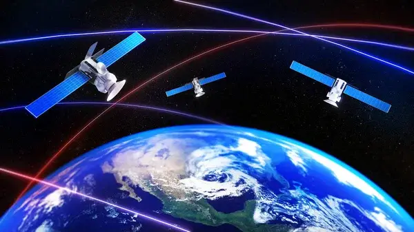
Daily Russian GPS jamming in and around sensitive geographic locations has generated concern among Western governments, transportation authorities and military operations over the two years of strife involving the war with Ukraine. As Russia tilts in the direction of conflict with NATO nations, concerns are ramping up even further.

A Newsweek report last month highlighted the long-term nature of the threatening trend. It quoted a spokesman for the Lithuanian Defense Ministry: “This Russian practice has, and will likely continue, to negatively affect the civilian aviation in the region.” A Polish Defense Ministry official added, “Building an atmosphere of threat and a sense of helplessness in society is undoubtedly one of the goals that Russia is pursuing.”

The Lithuanian official noted that Kaliningrad, a small but strategic Russian military outpost on the Baltic Sea between Poland and Lithuania, is a hub of Russian satellite interference. Based on Kaliningrad’s location, its wide variety of military jamming equipment is considered a threatening presence to NATO countries. The official told Newsweek, “In Kalinigrad Oblast, Russia also has these systems and uses them for GNSS [Global Navigation Satellite Systems] interference.”

In northern Europe, the Kola Peninsula is seen as another area where electronic warfare is active. The peninsula, which is within the Arctic Circle, was cited as a threat by Finnish and Norwegian officials and has been described as the “crux” of Russian military capability in the region.

Mark Phelps
Mark Phelps is a senior editor at AVweb. He is an instrument rated private pilot and former owner of a Grumman American AA1B and a V-tail Bonanza.

30 COMMENTS

  1. Putin’s Russia sure looks like a foe. The parallels between Putin’s Russia and the era of Khrushchev are clear. Nikita scared the hell out many, Putin is doing the same. People will die, economies will suffer, Russia will fail.

  2. I don’t believe Khrushchev was a psychopath, just cunning and smart. All bets are off with the new guy.

  3. A few well placed JDAM SDB’s oughta take care of this problem … along with a warning not to do that again. The commies only understand one thing … FORCE.

  4. I was soundly criticized when I rebuilt the panel in my airplane, putting in Dynon Skyview HDX and WAAS GPS, but keeping the StormScope, old VOR/LOC/GS and ADF. I think I made the right choice. I still have the old LORAN-C sitting on the shelf. Loran requires few terrestrial transmitters and is much harder to jam, and is pretty accurate except for a short sunrise/sunset window. GPS? that’s another story and always has been.

    • All the LORAN stations are gone. You can put the box back in your airplane, but it will just be dead weight.

    • Yeah … back in ’02, I bought a beautiful Cherokee that had a Northstar M1 (early) Loran in it. I loved the thing SO much that I bought some updated M2 and M3 (with GPS) units. Not long after that, they did away with Loran 🙁 . Now I have a box of that stuff next to my old computers taking up space. I agree … they shoulda kept Loran alive for just such a time.

  5. Raf Sierra: You are probably right seeing parallels between the historical present and the Khrushchev era. Just what was then called Cuba, now is called Ukraine. Like it or not.

  6. The old saying “There is no such thing as a free lunch” is certainly coming true for the FAA and other aviation authorities concerning global aviation navigation. The decommissioning of ground-based facilities in the U.S. and the adoption of GPS as the primary and sometimes only source of navigation data for aviation is proving to be a real problem. The FAA was eager to drop the costs of maintaining VORs and NDBs and transfer the costs of navigation to the DOD. The GPS signal is weak and easily disrupted or spoofed. While it can be encrypted to deny service for use only by the military, jamming using stronger signals is still a threat.

    But there are answers to this problem for commercial aviation. Inertial navigation units (INU) are in use and can still get aircraft where they are going while not providing the accuracy of GNSS. The main problem with INU is providing mid-course corrections and updates. Now this is automatically done using integrated GNSS data from one of the existing GPS networks. This could be replaced or supplemented by other means such as radar or even astro trackers. Recent developments in astro trackers may mean that future commercial aircraft may be equipped with a celestial navigation system linked to their INU. Of course, these also come with limitations.

    Solutions for general aviation? Who knows? We may have to break out the charts and plotters again and learn to navigate again.

    • You are absolutely correct, GJ. The B-52 used an air data method of nav supplanted by radar derived updates from known locations. The B-58 used an inertial accelerometer method supplanted by an automated star tracker which surprisingly worked during daylight. The problem with the inertial system (then) was near the poles; lines of longitutde were updating too fast for the system so there was a sly way they got around that (not worth describing). Ground based DME could supplant the updates these days, too. But to your point — yes — when I first heard of the FAA decommisioning VOR’s I thought … BIG mistake. Hopefully they won’t do that with localizers.

    • Costs were also transferred to airplane owners in the form of $$ spent on IFR databases. VOR’s and NDB’s may have their disadvantages, but they have no database that needs to be updated to be legal for IFR!

  7. Building an atmosphere of threat and a sense of helplessness in society is child’s play these days; jam the internet and jam GPS and watch the western world crumble. We kinda made it easy for people who have bad intent to now be able to disrupt vast 1st world areas. So yea, keep a few some paper maps and a compass.

    • Arthur, your comment brings in reasonable concerns about our dependence on technology and potential vulnerabilities, but it underestimates the toughness built into these systems and the ongoing efforts to secure them against threats. Also, suggesting the Western world could ‘crumble’ due to such disruptions overlooks the capacity for rapid response and adaptation from our side in the face of challenges, as we have the same capacity. However, while the fixings take place, if it ever comes to that point, I’m good with keeping traditional tools like maps and a compass; VORs, LOC, ILS, and ADFs suit me just fine.

      • Look at the number of industries that rely on the internet. Look at the number of delivery and transportation systems that rely both on the internet and GPS. Don’t even get me started on unencrypted and unauthenticated ADS-B systems.

        Some good reads are “”Red Metal” or Stephen Frey’s “Ultimate Power”.

  8. When I had my 172 back in the early 90’s I had a Garmin 100 GPS. I loved what it did at the time, but quickly realised it’s limitations while flying in Alaska because of coverage gaps then. Since that, I always believed that we are wat too dependant on GPS and that there should be an alternative means of navigation. Keeping LORAN or some version of that would have been the cost effective choice though where I was at, though having only one chain made navigation interesting at times.

  9. Back in the early 2000s, the Volpe Center published a report on backups to GPS. The clear winner was something called eLORAN or enhanced LORAN. Nothing like the old LORAN except power and frequency. It met Stratum I timing requirements like GPS, and you could treat eLROAN stations as ground-based satellites with pseudorange calculations just like GPS. No more hyperbolic curves and LORAN chains. GPS is low power, high frequency, and satellite-based, and eLORAN is high power, low frequency, and earth-based. GPS is more accurate, but eLORAN is more precise. I think Collins made a GPS-INS-eLORAN prototype avionics box, and it made rock solid fixes. Some political appointee in the Dept of Transportation killed it eLORAN. And here we are.

    • Kinda like let’s not complicate, go with GPS, screw all else. So ground based nav aids lost support. So, in essence, while the enthusiasm for GPS’s capabilities and the shift away from ground-based aids like eLORAN might have seemed pragmatic at the time, it is now coming back to bite.

      • ADF is a good way to find your way around and it can also be entertaining, especially when T-storms are brewing or you’re near the mountains but one should know that living where we are. eLoran has got to be the best ground based solution for large area and precise travel. Us fliers wouldn’t be the only ones using it.

        • ADF may well be safer as well as there are no magenta lines to follow, just a big, wide sky with plenty of room to try and follow a wiggling needle!

  10. You guys are all wrong. The best answer is multilateration! Kind of like GPS but inside-out, and it exists today and could be used easily by air traffic control, and with a small change it could be used by pilots.

    The FAA already has ground monitoring stations for ADS-B data that are time-synchronized. With three or four ground stations receiving ADS-B data from the same airplane, they can time the received signals and determine the airplane’s approximate location (even if the “advertised” GPS position from the broadcast is wrong or absent). ATC could use this data directly. The only thing missing is to then uplink the solution back to the aircraft.

    No, it’s not good enough for a CAT I approach, but it’s more than good enough for enroute navigation, and more than good enough to get you into the service volume of a minimum network VOR.

    • Most folks don’t know that if you ONLY have a Mode S transponder, that box is transmitting your aircraft’s ID to ATC. Before ADS-B, they could ID you before you checked in. When ADS-B came along — that’ the “Mode S – ES (extended squitter) — more digital data including position info is being transmitted in the clear. That’s how other airplanes with the ‘in’ capability can ‘see’ you directly but not with just Mode S.
      I got a crash course on multilateration when I installed an ADS-B out unit but purposely didn’t turn the ES function on for a quick flight checkout. Somehow, Flight Aware had my path as if I had ES on. It was due to multilateration. So you’re right about this idea BUT … it presupposes you have a transponder on and being seen by the sniffers and/or ATc. And then they’d have to transmit that info up to the airplane in some sort of ADS-B ‘in’ system.
      What I see as MORE likely and usable is a modern technology inertial unit. IF it was designed for non precision approach enroute nav, I think costs could be contained. I feel that having the ability to navigate WITHOUT external signals is the best way to go. Such a system would do that. Think about how crude the early GPS units were and their costs compared to today’s units. The same thing would evolve over time.

  11. According to GPS.Gov, the following excerpts are the facts leading to the ending of LORAN. In May 2009, President Obama, declared the system obsolete and announced plans to terminate it……. That year, Congress debated whether to retain and upgrade the LORAN-C infrastructure to become E-LORAN….. The Coast Guard began shutting it down in February 2010 in spite of a 2006 Independent Assessment Team (IAT) report commissioned by the DOT and Department of Homeland Security (DHS) which found that eLoran is the only cost-effective backup for national needs … . It is a seamless backup, and its use will deter threats to U.S. national and economic security from disruptive (jamming) GPS reception. IAT reiterated its support of eLoran in 2009…….. According to the Office of Management and Budget, shutting down loran-C will save $36 million in fiscal 2010 and $190 million over five years……….. In 1983, the United States made the decision to provide GPS service free of charge, and openly, to the world. The system was initially funded by the U.S. Department of Defense, and is currently managed by the U.S. Air Force. The cost of maintaining the system is approximately $1.5 billion per year. ………….. The 111th (2009-2010) congress did this. I will leave it to you to determine the motivation, implications and calculated consequences.

    • Very appropriate commentary. Us flyboys aren’t the only ones who would benefit from a land based nav system. Think about the marine industry which is probably as financially dependent as the commercial av sector. There will be other users as well in the oil, gas, mining and subsurface mineral exploration work who would like to rely on a dependable location fix for legal and financial interests. We need to think big on some of this stuff.

  12. Those low and slow microlights used last week, probably had a mix of GPS and mobile phone fixing.
    In a place like Russia, mobile coverage is poor, but probably good enough for position checking if GPS gets frizzed.

LEAVE A REPLY