This article originally appeared in the October 2002 issue of IFR Refresher and is reprinted here by permission.

The most serious mistake that I ever made in an airplane would not have happened without GPS.I was an enthusiastic instrument student with 15 hours of instrument flight under my belt. I had 30 hours of experience in the new IFR-equipped Skyhawk, and I was becoming more comfortable with its IFR-certified Bendix/King KLN89B GPS unit.My instructor was fresh out of flight school with only a few hours of experience in actual IMC conditions, and I was his inaugural student. The weather was IMC, and I was a little nervous about my first lesson in solid IMC conditions.After my most thorough preflight ever, we received our IFR clearance, taxi instructions and takeoff clearance, and promptly we were in the soup.We were flying from KRDU, a busy Class C primary airport in Raleigh, N.C., to KJNX, an uncontrolled field also served by Raleigh Approach Control. We were planning on shooting a few instrument approaches at KJNX and then returning to KRDU.Everything started off well. I carefully followed the headings and altitudes assigned by the approach controller. To enhance situational awareness, I set up the GPS unit direct to the NDB that served as the final approach fix for the localizer approach.I wanted the GPS unit to provide distance information relative to the NDB and also be available for the missed approach holding pattern at the NDB. I dialed in the AWOS and wrote down the local weather. I briefed the ILS approach into Runway 3, tuned and identified the localizer frequency and set up the local CTAF on my second radio.Raleigh cleared us for the approach and told us to report intercepting the localizer. I completed my GUMPS checklist, set the DG against the magnetic compass heading and intercepted the localizer.
No Glideslope
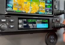
The needle quickly centered with a TO flag, and I felt that things were going quite well. Then I noticed that the glideslope still was flagged. I double-checked the localizer frequency and identified it again, but still no glideslope.With a slightly higher-pitched voice than normal, I asked my instructor if he had “done something.” He hadn’t. We reported to Raleigh approach that we were established on the localizer but were not receiving the glideslope. Somewhat frazzled, I began to mentally prepare for the localizer-only approach.At this point, Raleigh Approach normally would terminate radar service and approve a change to the CTAF frequency. Fortunately, that did not happen. The controller re-examined our position on radar and again asked us to verify that we were established on the localizer.My instructor and I both concurred that we were established on the localizer and reported that to the controller. The controller showed us well off course, terminated our approach clearance and began to vector us for a second approach.What happened? With a little more time on our hands, my instructor and I began to evaluate the problem. We were stumped until we noticed the little button labeled NAV/GPS at the top of the panel. The GPS mode was selected!In other words, even though we had correctly tuned and identified the localizer frequency, the course displayed on the CDI was an arbitrary GPS course and not the intended localizer course.Had we attempted to descend on a localizer-only approach, we would not have had any obstacle clearance protection. If we had been outside of radar coverage, we would not have had the assistance of the controller to prevent this mistake.I felt a lot older and a lot wiser by the time I got back on the ground.Sitting there doing zero knots, you probably guessed the problem early on and have been laughing at our plight. But this relatively commonplace situation illustrates the primary danger of GPS: increased complexity.The vast majority of GPS installations use the primary CDI for both VOR/LOC and GPS navigation. Typically, a single button determines which mode is selected. The mode is either displayed on a separate annunciator panel or on the GPS unit itself.The safest installations have an annunciator built directly into the CDI, significantly reducing the probability of making this mistake. It is possible, however, to make this mistake with most GPS installations.How could we have prevented this problem? We could have tuned the localizer frequency in our second nav/com, and we would have noticed the disparity between the CDIs. It’s always a good practice to back up the primary navigation source.After making this same mistake in VMC conditions, one of my instrument students came up with an excellent suggestion: Make identification of navaids a two-step procedure. Step one: Check the annunciator mode. Step two: Tune and identify the navaid.
Auto Nav Mode
Some GPS manufacturers also have anticipated this problem. Garmin implemented an option on the 430/530 to automatically switch to the NAV mode (VLOC) when established inbound on the localizer.In other words, on a localizer-type approach, the unit will switch from GPS mode to NAV mode without any action required by the pilot. This ensures that the CDI will display the localizer course when a localizer frequency is selected.Finally, many of the latest generation of GPS receivers have ILS/LOC approaches in their databases. GPS cannot be used as the primary means of navigation for ILS or localizer-type approaches, but it can be used for situational awareness and often as the primary means of navigation to fly the missed approach and holding pattern.With the proper approach selected, it still would be possible to select the wrong navigation mode, but at least the appropriate course would be selected.Selecting the wrong navigation mode is a very serious mistake, but it’s not the only potential problem with GPS navigation. Although procedures vary across GPS manufacturers, I would like to examine a few other GPS-related pitfalls.
OBS Mode
The OBS (sometimes called “hold” or “suspended”) mode often is required for course reversals and holding patterns. It frequently is required when flying a specific missed approach course as well.The OBS mode suspends the automatic sequencing of waypoints and allows the pilot to fly a specific course, often selected using the OBS knob on the primary CDI.If the OBS mode is not selected when required, it’s likely that both the course and the active waypoint will be incorrect. This can be very distracting in turbulent IMC conditions.If the unit is not returned to LEG (sometimes called “auto”) mode when required, the GPS unit will fail to transition to the active or approach mode. In this case, the waypoints will not sequence properly and the CDI sensitivity will not be sufficient to complete the approach. A missed approach will be required.The OBS mode often is very confusing to instrument students and to pilots unfamiliar with GPS navigation.Unfortunately, the lack of standardization in the industry makes it impossible to transition or upgrade from one unit to another without extensive review of the manual and a significant amount of practice and training to obtain proficiency in the airplane.Garmin again reduces the workload and potential for errors by incorporating an ingenious algorithm to automatically switch between OBS and LEG mode in the 430/530. Manual intervention is only required to activate the missed approach.
RNAV T-Approach
The Garmin algorithm isn’t perfect, however. When executing a basic RNAV T approach, the Garmin 430/530 expects the pilot to fly the standard racetrack holding pattern provided at the center IAF.Unfortunately, no procedure turn (NoPT) is the standard for RNAV T approaches, and the holding pattern is not authorized unless coordinated with ATC.As a result, the holding pattern must be deleted from the approach section of the flight plan before flying the approach.If this step is overlooked, waypoint sequencing will be suspended at the same time that the pilot is expecting to transition to the final approach fix. Again, this is not a good time for surprises in IMC conditions.
Customization
The latest GPS technology and software allow each user to customize individual display fields on navigation and flight plan pages and offer numerous menus with many additional options. The end result approaches both the capabilities and complexity of an airline flight management system.This level of customization comes with a price. Due to the vast array of customization options, the lack of standardization now applies to individual GPS units, not just to different product lines.For the rental pilot and the flight instructor, the implications are significant. It can take up to half an hour on the ramp to fully examine and modify all of the user options to eliminate any surprises in flight.This assumes a thorough knowledge of the individual unit. If we do not spend this time, we could compromise the safety of our IFR flight.
Regulations
The risks of flying IFR with GPS navigation are not limited to the operation of the GPS unit. There are a number of new ways to run afoul of FAA regulations that are specific to GPS navigation.For example, all installations have a GPS IFR equipment class and category that determine the approved IFR operations. To determine the approved uses and limitations in a specific airplane, refer to the AFM or AFM supplements.To legally fly approaches, the database must be current. New GPS databases are issued every 28 days. The expiration date of the database typically can be verified on one of the startup screens.Here is an obscure requirement that few pilots are aware of: If an alternate is required, the alternate airport must have a non-GPS approach and the airplane must be equipped to fly that approach.There actually are few GPS-specific regulations, but they can cause problems for pilots new to the world of satellite navigation.
Lack Of Familiarity
There is one risk common to flying IFR with all GPS units: lack of familiarity that leads to pilot distraction. If we are not completely familiar with the operation of our GPS units, even simple tasks will distract us from our instrument scan.Repeated distractions from our instrument scan in IMC conditions can lead to deviations in altitude and heading or even inadvertent opportunities to practice steep turns and recovery from unusual attitudes.We must be proficient in the operation of our GPS units to minimize distraction and to help us to stay ahead of the airplane.
Two Rules
As a means of evaluating your proficiency, there are two rules that I use for my instrument students. The first is the three-second rule: Do not look away from the primary flight instruments for a period of more than three seconds.The second is the 80/20 rule: At least 80 percent of your time should be spent scanning the primary flight instruments and no more than 20 percent should be spent scanning navigation instruments.These two rules ensure positive control of the airplane and eliminate the habit of chasing the needles. They also will quickly expose a lack of proficiency in GPS and other forms of navigation.Before I am burned at the stake for tarnishing the reputation of GPS, it is time for me to come clean. I love flying under IFR with my GPS unit. With adequate preparation and training, an IFR-certified GPS unit greatly simplifies IFR flight, enhances safety and increases utility. Without adequate preparation, however, the risks are considerable.


