AVweb’sGeneral Aviation Accident Bulletinis taken from the pages of our sister publication,Aviation Safetymagazine, and is published twice a month. All the reports listed here are preliminary and include only initial factual findings about crashes. You can learn more about the final probable cause in the NTSB’s website atwww.ntsb.gov. Final reports appear about a year after the accident, although some take longer. Find out more aboutAviation Safetyatwww.aviationsafetymagazine.com.
May 18, 2018, Crescent Mills, Calif.
Cessna 182D Skylane
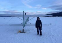
At about 0809 Pacific time, the airplane experienced a total loss of engine power while maneuvering. The pilot subsequently executed a forced landing into a river. The private pilot and passenger were not injured; the airplane sustained substantial damage. Visual conditions prevailed.
Approaching the destination airport, the pilot observed low fog in the valley. He executed a long counter-clockwise circle around the valley and fog. As the circle completed and at a low power setting, the engine abruptly lost all power. The pilot established the best glide speed and proceeded toward a river. Attempts to restart the engine were unsuccessful. The descent continued and the airplane landed in the river, impacting rocks and coming to rest. The airplane impacted rocks and came to rest nose-down with its left wing in the water.
May 20, 2018, Bennington, Vt.
Piper PA-34-200T Seneca II
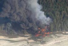
The airplane was destroyed at about 1423 Eastern time when it collided with wooded terrain while maneuvering. A post-crash fire ensued. The solo instrument-rated commercial pilot was fatally injured. Visual conditions prevailed.
Over the previous three days, the pilot had obtained a commercial pilot and certified flight instructor certificate with a multi-engine land rating. The designated pilot examiner reviewed weather with the pilot on May 19 for his flight back to his home airport. The DPE advised the pilot to delay his departure a day until the weather improved.
While en route, the pilot was receiving flight following services from the Albany (NY) Approach Control facility. The controller advised the pilot of precipitation and nearby mountainous terrain. In response to a question, the pilot reported cloud bases were at 3,000 feet when the airplane was at 3,400 feet. Shortly, the airplane’s altitude was varying between 3,200 feet and 4,000 feet MSL over an area where ATC’s minimum vectoring altitude was 5,000 feet. The airplane briefly turned to a westbound heading, then turned back to a southeasterly heading. The controller advised the pilot that if he continued on the present heading, radar coverage would be lost. While the pilot was turning back to a westerly heading, radar and radio contact were lost. The last radar target was plotted at 1423:41, at 3,500 feet MSL and a groundspeed of 218 knots. The accident site was at approximately 2,625 feet MSL.
The main wreckage came to rest upright and was oriented on a 265-degree magnetic heading. Both propellers exhibited damage consistent with being under power. The attitude indicator was disassembled, and its gyro and gyro housing exhibited rotational scoring. Weather recorded at a station about five miles west-southwest of the accident site and at 827 feet MSL at 1415 included visibility of 10 miles, a few clouds at 1,700 feet AGL, a broken ceiling at 3,600 feet and an overcast ceiling at 4,600 feet.
May 22, 2018, Daytona Beach, Fla.
Cessna 140
At about 1930 Eastern time, the airplane was destroyed when it impacted terrain. The commercial pilot was seriously injured; the pilot-rated passenger was fatally injured. Visual conditions prevailed.
Witnesses observed the airplane making touch-and-go landings. During the third touch-and-go, the airplane had climbed to about 200-300 feet AGL when the engine “sputtered,” revved up, sputtered a second time and then experienced a total loss of power. The witnesses observed the airplane make a left turn like it was trying to return to the runway. During the left turn, the airplane descended steeply and impacted the ground.
All major components were accounted for at the scene. Control cable continuity was confirmed, the fuel selector valve was in the right tank position and the throttle and mixture controls were in the full forward position. The magneto switch was in the BOTH position. About 3.25 gallons of 100LL aviation fuel were found in each wing fuel tank.
May 25, 2018, Santa Fe, NM.
Beechcraft D17S Staggerwing
The airplane impacted terrain at about 1342 Mountain time. The solo commercial pilot was fatally injured and the airplane sustained substantial damage. Day visual conditions prevailed.
The airplane was in cruise flight at 10,500 feet MSL and receiving flight following services from ATC. It entered a descent at 1340:11 for unknown reasons. The final radar return was recorded at 1342:48 at 7,900 feet MSL (650 feet AGL) about 1.25 nm east-northeast of the accident site.
May 27, 2018, Omaha, Neb.
Beechcraft P35 Bonanza
At 0840 Central time, the airplane impacted terrain following a loss of control during takeoff. The pilot and pilot-rated passenger sustained fatal injuries; the airplane was destroyed by a post-impact fire. Day visual conditions prevailed.
Witnesses observed the airplane attempting to take off. During the takeoff roll, about 1,300 feet from the departure end of Runway 30, the airplane exited the left side of the runway, traveled through several grass medians between the runway and taxiways, onto several taxiway surfaces and was briefly airborne during portions of the runway excursion. The airplane crossed the end of the runway, became airborne and then appeared to stall. The airplane’s right wing struck the terrain, the airplane cartwheeled and a post-impact fire ensued. The witnesses stated the airplane looked like it was out of control during the takeoff sequence. During the runway excursion, the airplane impacted several runway and taxiway light structures.
The main wreckage came to rest inverted about 200 feet from the end of the runway and was consumed by fire. The 0835 automated weather observation included wind from 240 degrees at seven knots and clear skies. The calculated density altitude was 3,150 feet.
This article originally appeared in the August 2018 issue ofAviation Safetymagazine.
For more great content like this,subscribe toAviation Safety!


