ForeFlight Introduces Reported Turbulence Map
ForeFlight’s latest release features a Reported Turbulence Map—allowing pilots to see where aircraft are encountering turbulence using information sourced from the company’s Sentry ADS-B receivers. “No one enjoys flying through…

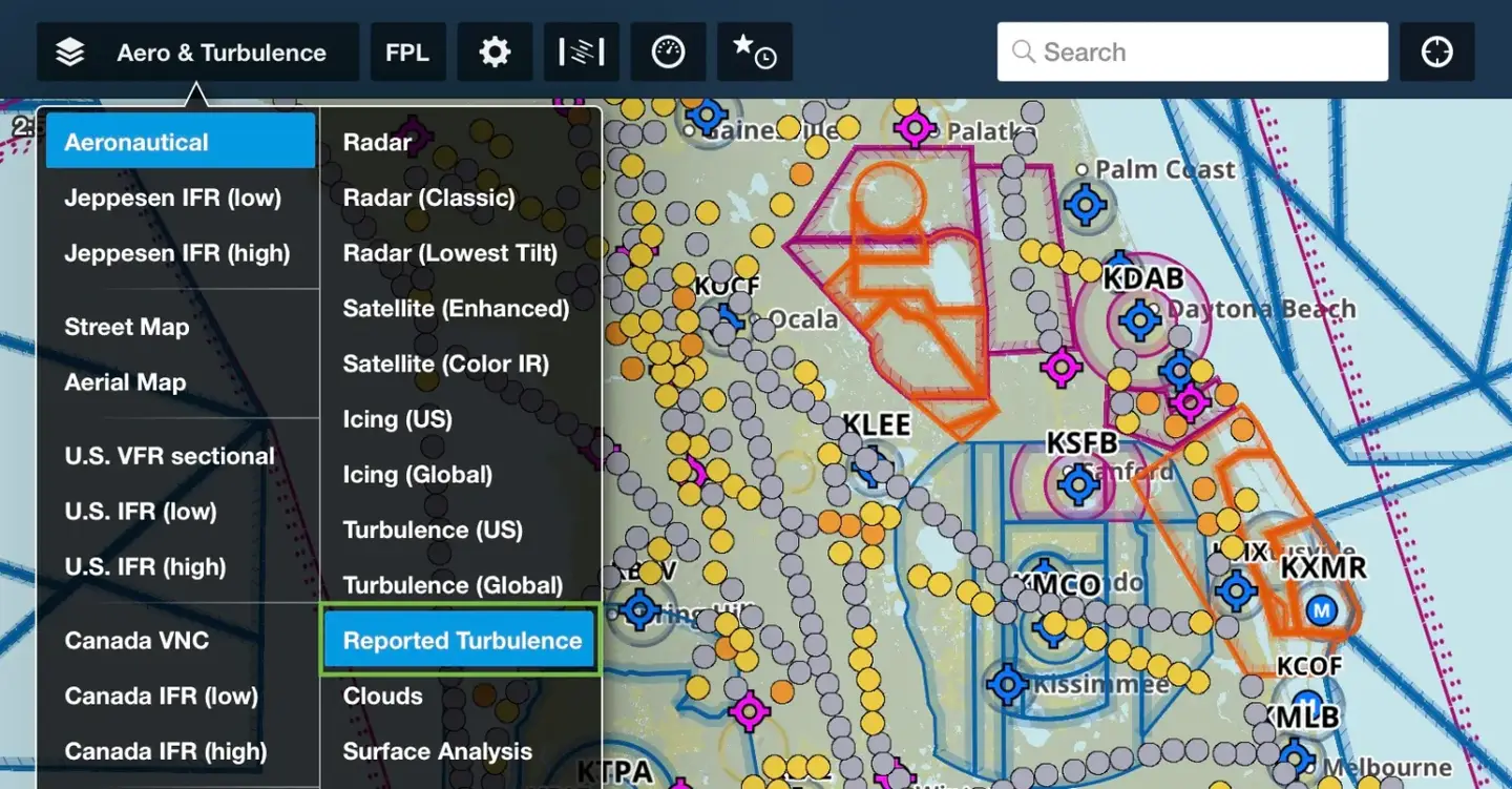
ForeFlight’s latest release features a Reported Turbulence Map—allowing pilots to see where aircraft are encountering turbulence using information sourced from the company’s Sentry ADS-B receivers.
“No one enjoys flying through turbulence, whether you’re piloting a single-engine piston or riding in the back of a jet,” said Henrik Hansen, ForeFlight’s chief technology officer.
ForeFlight says the additional feature within the mobile app displays the measured intensity of turbulence at multiple altitudes, making it easy for pilots to find the smoothest altitude along their flight path. ForeFlight Mobile automatically uploads the reports once it establishes an internet connection after the flight or instantly if connectivity is maintained during flight, according to officials.
Turbulence reports are depicted as colored markers on the Maps tab: Gray signifies smooth air, while yellow, orange and dark orange represent increasing levels of turbulence, ranging from light to severe.
While pilots traditionally rely on weather forecasts and PIREPs for route planning, ForeFlight says its Reported Turbulence method offers distinct advantages, including enhanced accuracy and objective reporting.
ForeFlight estimates its Reported Turbulence layer offers 50 times more turbulence reports than manual PIREPs, per Sporty’s IPAD Pilot News.
Reported Turbulence is available as two add-ons for Pro Plus subscribers. Reported Turbulence (Low) offers access to turbulence reports up to 14,000 feet, whereas Reported Turbulence (All) provides access to reports across all altitudes.


