


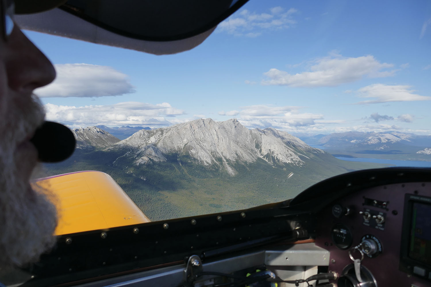
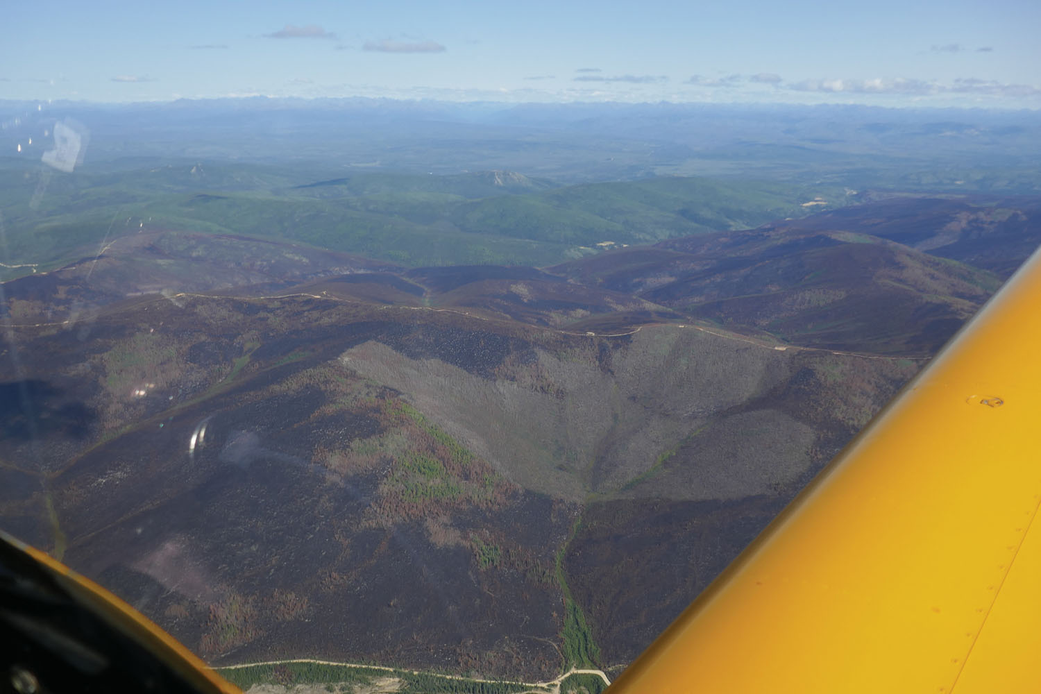
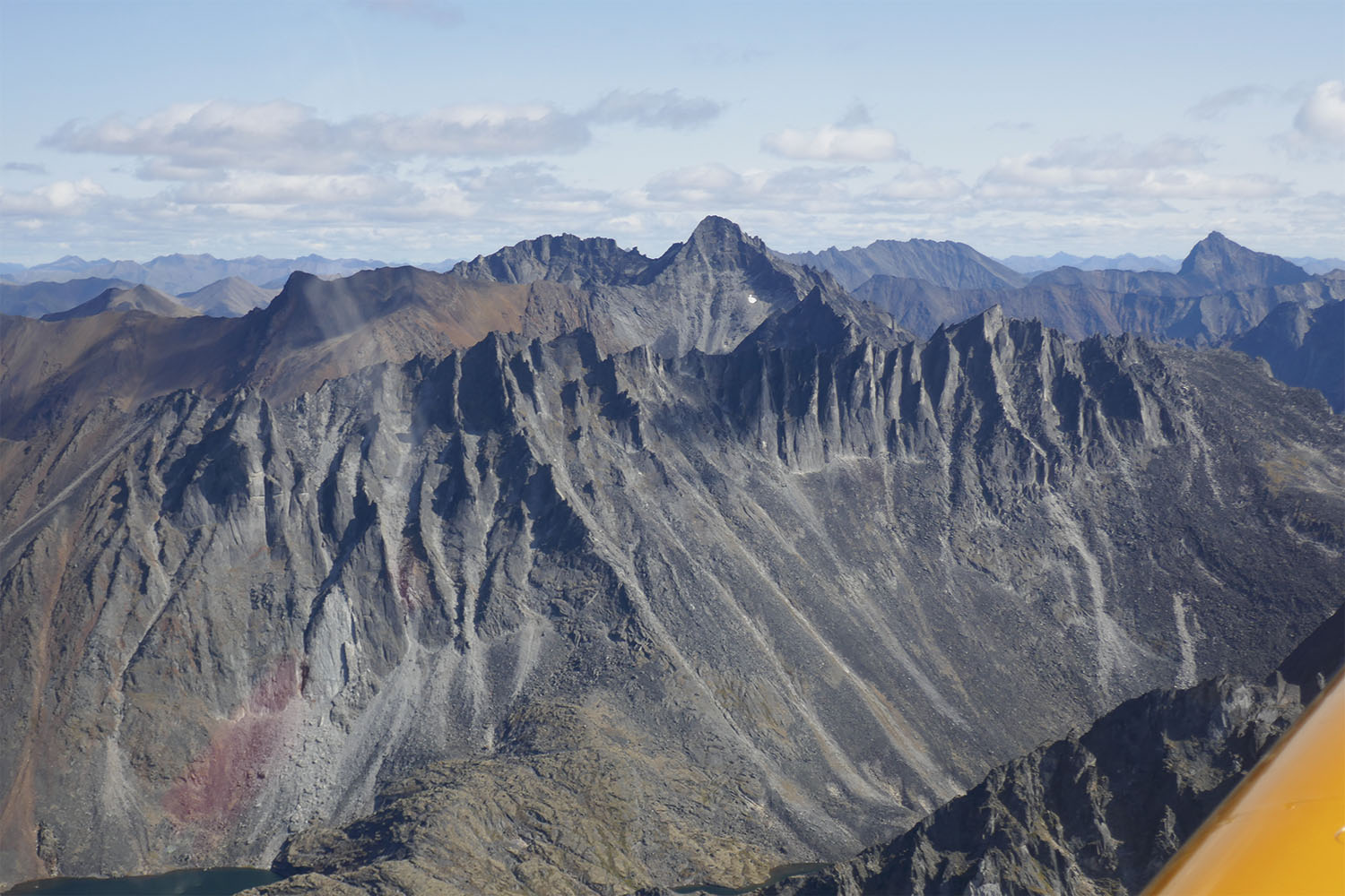
I gazed through the canopy at the dark mountains, range upon range marching into the distance. Even though it was August 9, fresh snow dusted several ragged peaks. Our little RV-9 purred along beneath a layer of scattered clouds while below us steep scree and rock slopes descended sharply into thick forest.
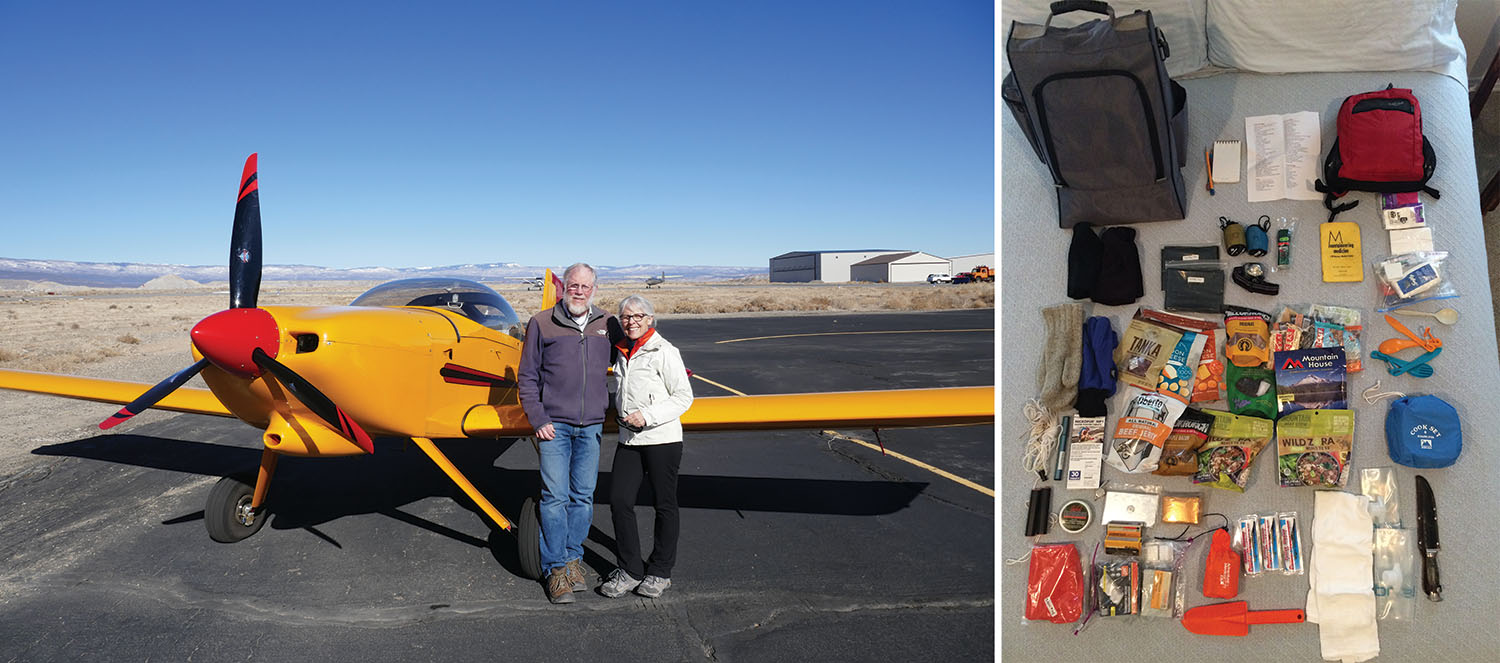
I met my husband, Greg, when we were both student pilots at Lake County Airport in Leadville, Colorado, in 1979. He learned to fly out of a sense of adventure while I learned to fly to save myself. At the time, my father had corralled me into being his spotter on Civil Air Patrol missions. One day during a search I realized that if something happened to Dad I wouldn’t know how to get the plane down, so I started taking flying lessons. During my training I became aware that I have no talent for piloting, so when Greg and I started flying together I preferred that he be pilot in command. He flies the plane and I—well, we tell people I navigate, but we share that task. I secretly like to think of my job as the voice of caution in the cockpit.
“Are we doing something stupid?” I asked.
Greg and I looked at each other.
“Because,” Greg said, “there are no decent emergency landing spots?”
We both sighed. All day we’d been flying over trackless wilderness.
“And because we’re tired,” I replied. We had been flying since early morning, now adding tomorrow’s planned flight to the end of today, due to an approaching storm. “Are we pushing ourselves just to avoid paying for a hotel room for a few nights?” I asked.
“We can still go back,” Greg offered.

Meanwhile, the RV kept plunging ahead at 165 mph, passing yet another craggy ridge. Before us, in the midst of the Mackenzie Mountains in the Northwest Territories of Canada, rose a tall mountain with a glacier perched on it like a haphazard white collar.
We considered the facts: our engine had worked perfectly for years, so it seemed unlikely to quit. But if it were to quit, Greg pointed out, our RV-9 has a glide ratio of 11-to-1, giving us time to find someplace to land. The terrain below looked unforgiving, forcing us to discuss landing in creeks or the tops of trees. We reviewed the emergency checklist and our plan: Greg would fly while I handled the radios, PLB, InReach messenger, and the ELT.
At that point it was less than two hours to our home base in Atlin, British Columbia, where we have a cabin.
“Okay,” I said, “let’s keep going, but put on your oxygen.” We were under minimum altitude, but it would boost his mental clarity. I already had my oxygen on.
Pre-Trip Planning
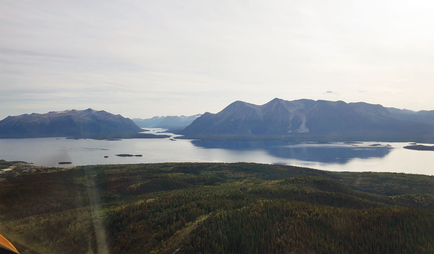
Our wild adventure to the Arctic coast had started in Atlin’s tiny library. Atlin, a town of 300 residents, sits on the edge of 80-mile-long Atlin Lake, surrounded by mountains and glaciers. In 2013 we’d built a log cabin outside town where we now spend our summers, enjoying cool temperatures and long days. With no TV, no phone service and only intermittent internet, we read a lot.
Atlin’s library has a fine collection of books about northern Canada. In 2018 we read about explorers in the Barren Lands—the land beyond the northern tree line—where the tundra is dotted by innumerable lakes and cut by ancient rivers. Intrigued, we wanted to see this unusual place for ourselves, and what better way to see it than by air? We started planning for summer, 2019.
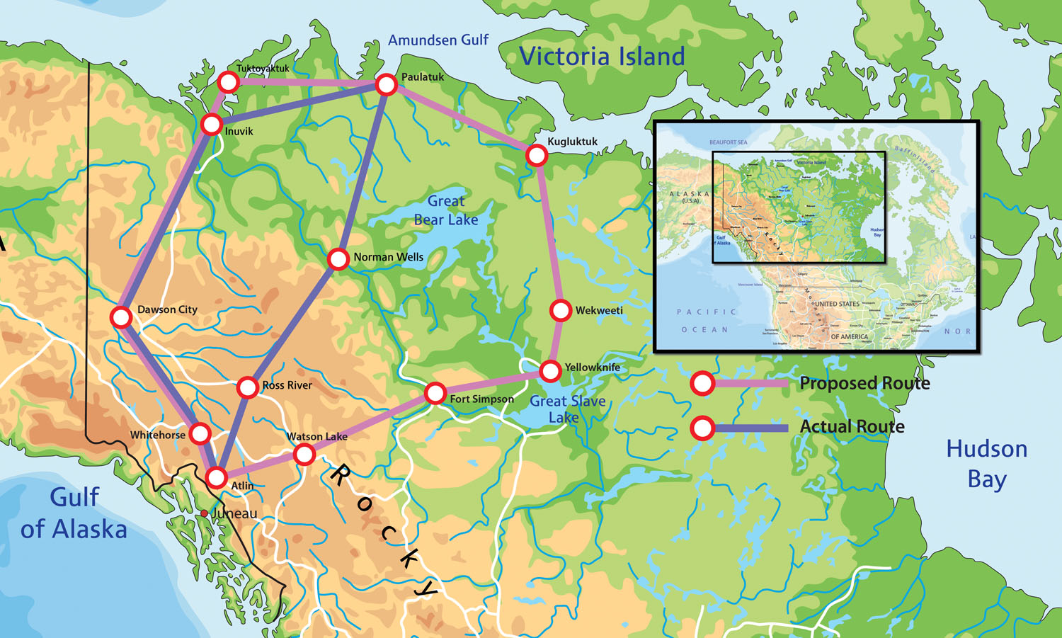
Greg liked a four- or five-day loop route: Atlin north to Dawson City, northeast to Inuvik, east to Paulatuk then Kugluktuk, both on the Arctic coast, then south to Yellowknife, southwest to Watson Lake, and finally west back to Atlin. The prevailing winds would favor flying this clockwise loop, but at times the winds shift, making counterclockwise more favorable. On this trip the wind would matter because there were not many alternate airports along our route and few offered fuel.
For instance, Paulatuk did not have any avgas, and Kugluktuk was out of fuel for the year because the supply barge had been shut out by sea ice the previous fall. Paying a charter to deliver a barrel of avgas was prohibitively expensive. Eventually Greg got word on a spare barrel of avgas we could purchase in Kugluktuk. This made the loop possible but left the leg between Inuvik and Kugluktuk still precarious, with at most one hour of extra fuel—not much reserve in the emptiness of the Arctic. We would have to carry extra fuel in gas cans.
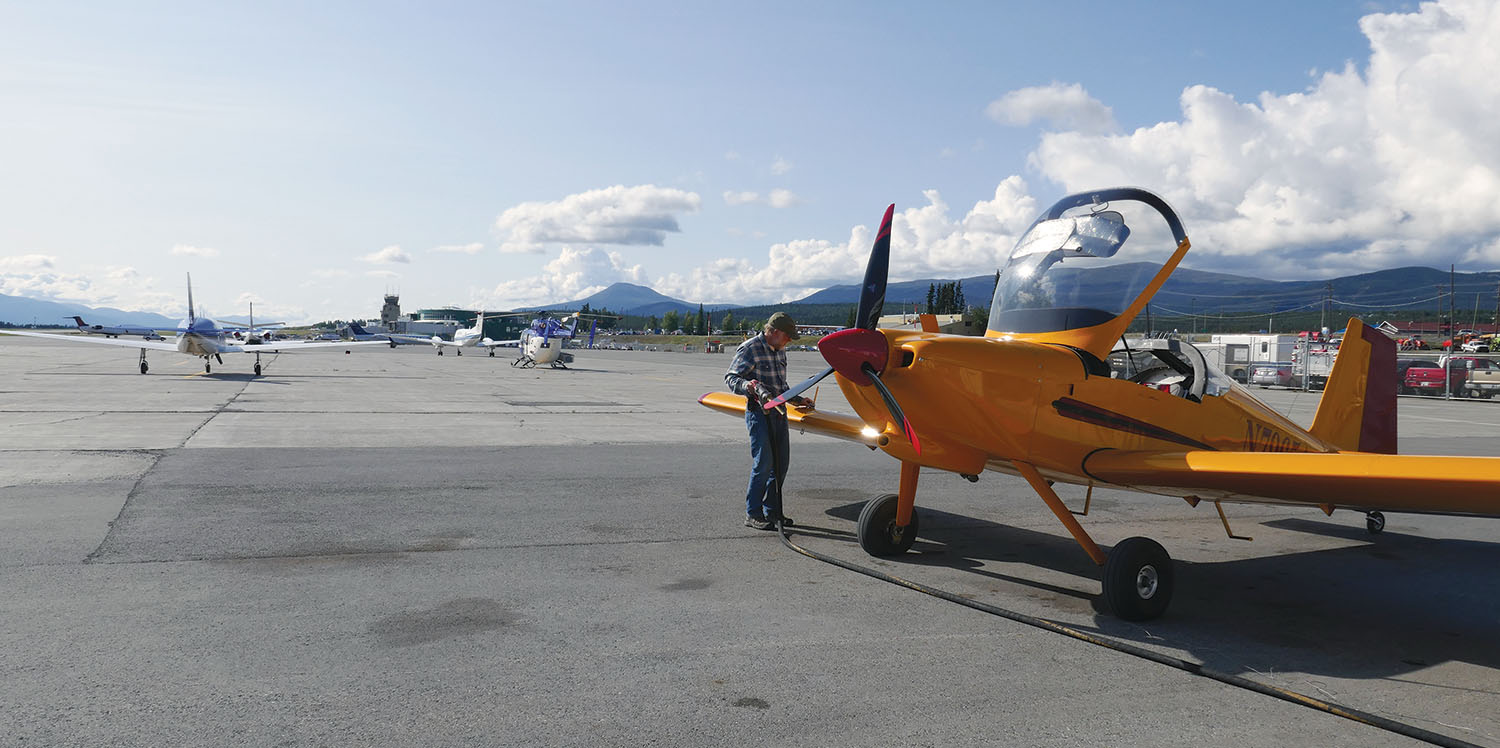
We were warned that accommodations on the coast fill up in advance for the summer, so we should be prepared to camp. Camping gear is part of our survival equipment, as required by Canadian Aviation Regulations for flights over remote wilderness, but we added to it. Greg put our bigger tires on the RV. For bear safety, we decided against carrying a gun or bear spray, instead opting for my pen-sized bear banger, with four “scare cartridges” (like loud firecrackers) and four flares.
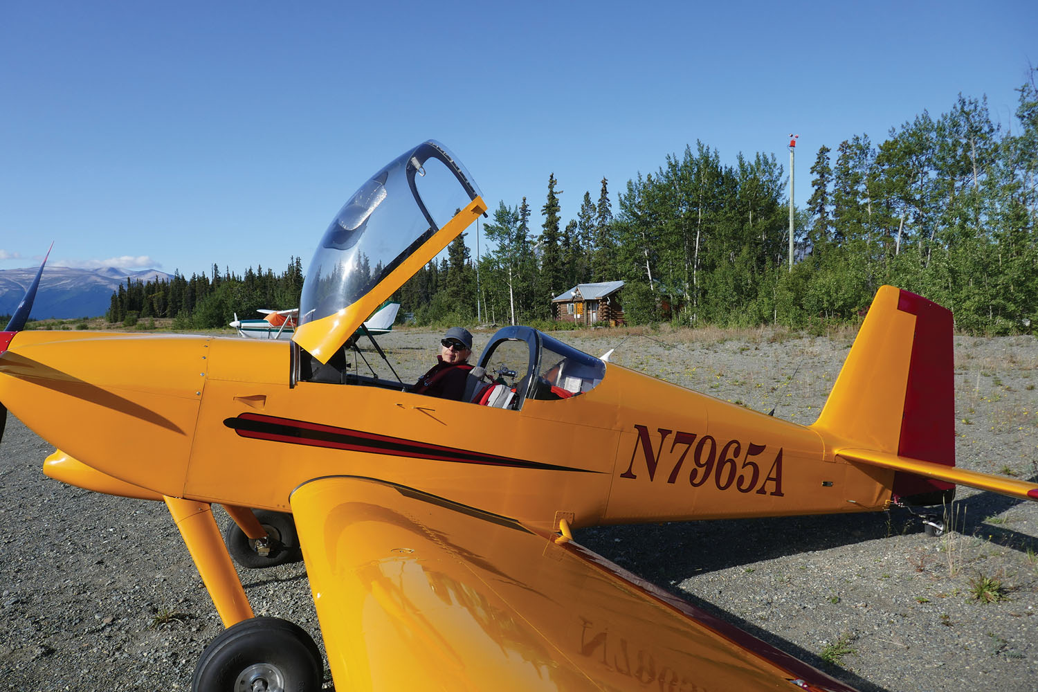
Our friend Mike planned to join us in his RV-6A. Having two airplanes increased the safety factor, and Mike could carry the extra avgas since he had no passenger. He would have to fly from Nevada to Atlin first, to join us there. For that matter, we would have to fly to Atlin too, from our residence in Colorado. Flying across the border and along the length of British Columbia is its own adventure, but another story.

Mike arrived in Atlin at the end of June. Right away we started watching the weather. Every day rain, fog or high winds impinged on some section of our intended route, and smoke from wildfires in Alaska and the Yukon obscured the sky over Dawson City, sending haze eastward and as far south as Atlin.
Our plan morphed as we tried to fit it into the weather and smoke predictions. We downsized the route to three days, cutting out the western half by going north through Norman Wells. Still, day after day the weather and smoke would not allow even the shortened route, and after ten days Mike had to go home. It looked like our adventure was doomed.
But at the beginning of August the smoke cleared, and Greg and I started watching the weather again. Predictions looked promising for three days, for a route to Dawson City, Inuvik, Paulatuk, Norman Wells, and back, before a storm front would arrive from the west. We packed quickly, including two small empty gas cans, drove to Atlin Airport and loaded all our gear into the RV-9.
Finally Flying
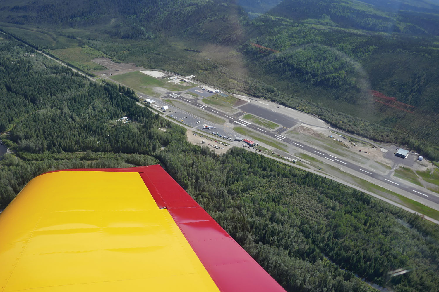
We took off the morning of August 8, headed north to the Yukon Territory. As we neared Dawson City, we saw black hills and ridges smoldering from the recent fires. Brash mining scars of the old Gold Rush days, as well as new workings, traced every waterway. We landed and filled our tanks.
Heading northeast, we flew beside the sharp spires of the Tombstone Range. Our straight track paralleled the winding Dempster Highway, the 460-mile-long gravel road to Inuvik. As hours passed we crossed two more mountain ranges separated by flat plains, watching the uninhabited country slip by below. Our digital charts went black as we crossed into the Northwest Territories, and I had to crack open an old-fashioned paper chart.
Near Inuvik, the Mackenzie River invades a broad plain on its way to the Arctic Ocean, creating a watery maze as far as the eye can see. On the Canadian chart the area looked like a Swiss cheese of confusing channels, pools, and lakes, inspiring appreciation for our GPS. We landed at Inuvik and got fuel, filling our gas cans and wrapping them in heavy trash bags to contain the fumes. The tie-downs were buckets of concrete, presumably for use in snow, along a line of electric plug-ins for engine heaters in winter.
The population of Inuvik is 3500, mostly native, and although it is one of only two towns in the Canadian Arctic with road access, most travel is still by air. We found the terminal well equipped—a baggage carousel and multiple check-in desks—and decorated with a taxidermic polar bear on its hind legs and a circumpolar map painted on the floor.
After checking into a hotel and finding dinner, we walked around the quiet town in the sunshine of a northern evening, then checked the weather. The storm front was going to catch up to us earlier than expected, with IFR conditions predicted for Inuvik by late the next morning.
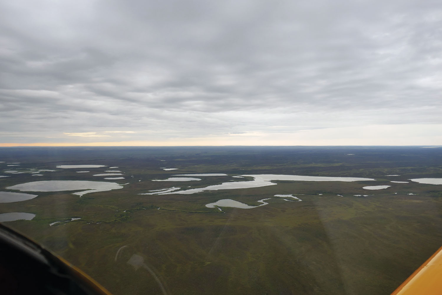
Under gloomy clouds we departed the next day, headed east toward a distant clear sky. We flew over a level plain of lakes upon lakes for many miles; the ground looked boggy, forested with dark spruce. The snaking valley of the Anderson River was filled with ominous fog when we crossed over it. Soon sea fog spilled over the land from the north, gradually moving toward our path.
Pacific Radio, the general remote-use frequency, had been silent all morning, but just as we discussed abandoning our planned stop in Paulatuk due to the fog, we heard the pilot of a commercial flight state his position: halfway from Inuvik to Paulatuk, above us. Greg asked him the conditions at Paulatuk, and the pilot told us the airport was reporting a 1500-foot ceiling. We looked again.
“That’s not fog?” I asked.
“One way to find out,” Greg replied.
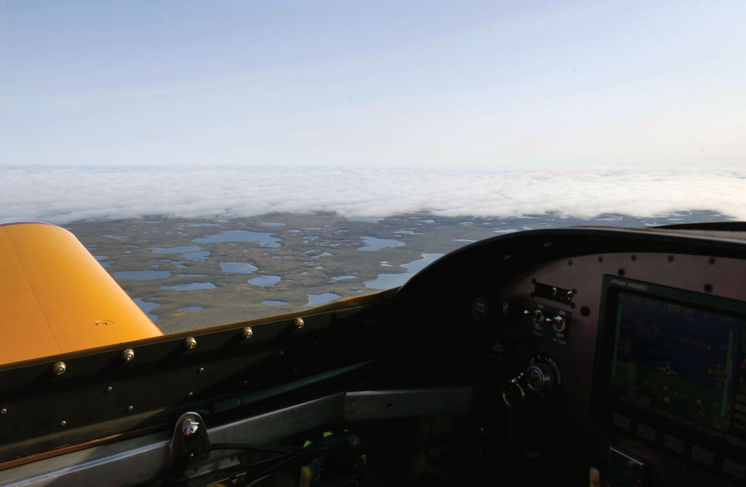
Greg took the plane down along the edge and sure enough, it was a thin cloud layer at 1500 feet AGL with a bright band of clear air below. Turning north, the plane raced toward Paulatuk only 800 feet above the ground. We were now definitely beyond the tree line: Tundra and patterned ground surrounded shallow pools and stark rock, with no track or sign of humans. The Barren Lands.
Soon the Arctic Ocean, slate gray and clear of ice, came into view, with the gravel runway of Paulatuk Airport lined up on a spit of land. The tiny one-room terminal bustled with passengers leaving on the commercial flight, with the pilot serving as baggage handler, ticket-taker, and flight attendant.
We walked the half mile to Paulatuk, where prefab houses sat on jacks instead of footers because the permafrost ground sinks and rises. Along two short muddy roads (the only streets in town), residents waved as they drove by us on quads. A short crescent of sand served as marina for a few small boats. Under the gray sky a cemetery of white crosses overlooked the gray sea.

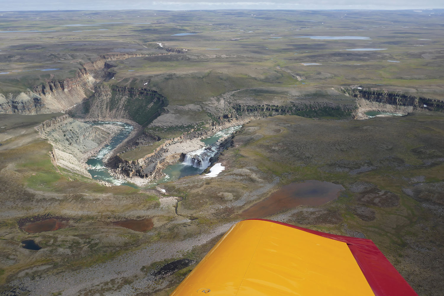
After emptying our gas cans into the tanks, we departed Paulatuk headed southeast, escaping the low clouds. We followed the canyon of the Hornaday River, with snow banks dotting its rim, to La Ronciere Falls, a dramatic waterfall in remote Tuktut Nogait National Park. After circling for photos we headed south, over the hypnotic landscape of endless lakes and tundra. At last we spotted the first trees along a river then, a bit at a time, more and more trees, until all below was water or trees.
The Approaching Storm

At Norman Wells, a small town on the Mackenzie River, the surrounding landscape had transformed into a valley with mountains beyond. It was here we planned to spend the night and fly home to Atlin the next day, but the fuel operator mentioned the coming storm, now expected to pack into the mountains by nightfall, prompting us to check the weather once again. It came down to this: Go now, straight across the Mackenzie Mountains, or stay and get stuck for several days and probably have to divert due to lingering weather.
We thought for a moment, staring across the river to the green foothills with sunlight and shadows darting across them.
“I would prefer to see the mountains,” I confessed.
“Let’s start,” Greg suggested. “If we need to, we can turn around and come back.”
With our oxygen on we crossed the rugged Mackenzie ranges without incident, stopping for a break at lonely Ross River Airport on the other side. After the last hour through familiar territory, we landed on the gravel runway at Atlin. It was the day after we had departed.

“Were we really on the Arctic coast at noon?” I asked.
“Seems a lot closer than we thought,” Greg replied. Then, with a grin, he said, “We’ll have to go back.”
Driving to the cabin, we started planning.
Photos: Julia Arehart
This article originally appeared in the May 2020 issue of Kitplanes magazine.
For more great content like this, subscribe to Kitplanes!

Heckuva story. Pretty gutsy trip but I bet it was fun!
Soiunded like a smart and safe, but short trip (in days).
You can always get to Yellowknife and Great Slave on another trip (hopefully)!
Thanks for sharing.
Awesome narration…felt like I was flying with you.